Yucca Valley geodata
Yucca Valley (California) is a populated place; located in United States in America/Los_Angeles (GMT-7) time zone. With population of 21,600 people, there are 2342 cities with bigger population in this country. Compared to other cities in United States, 79.5% of cities are located further ↑North; 89.3% of cities are located further →East and 93.6% of cities have lower elevation than Yucca Valley. Note1


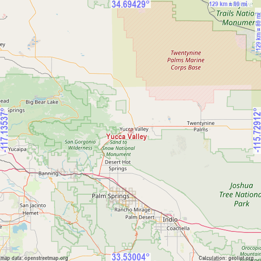
Yucca Valley GPS coordinates[2]
34° 6' 51.012" North, 116° 25' 56.064" West
| Map corner | latitude | longitude |
|---|---|---|
| Upper-left | 34.69429°, | -117.13537° |
| Center: | 34.11417°, | -116.43224° |
| Lower-right: | 33.53004°, | -115.72912° |
| Map W x H: | 129.5×129.5 km | = 80.5×80.5mi |
| max Lat: | 71.29058° ⇑79.5% North |
| Yucca Valley: | 34.11417° |
| min Lat: | ⇓20.5% South 19.06759° |
| min Long | Yucca Valley | max Long |
| -171.73463° | -116.43224° | -66.98998° |
| W 10.7%⇐ | ⇒89.3% E |
Elevation
Elevation of Yucca Valley is 1027 m = 3369 ft, and this is 732.2 m = 2402 ft above average elevation for this country.
| Max E: |
3189 m = 10463 ft | 6.4% |
| Yucca Valley | 1027 m 3369 ft | |
| Avg. | 294.8 m = 967 ft | |
Min E: |
-60 m = -197 ft | 93.6% |
See also: United States elevation on elevation.city.
Geographical zone
Yucca Valley is located in North temperate zone (between Tropic of Cancer and the Arctic Circle). Distance of this Northern Tropic circle is 1187.2 km =737.7 mi to South.| Distance of | km | miles | from Yucca Valley |
|---|---|---|---|
| North Pole | 6213.9 | 3861.1 | to North |
| Arctic Circle | 3608 | 2241.9 | to North |
| Tropic Cancer | 1187.2 | 737.7 | to South |
| Equator | 3793.1 | 2356.9 | to South |


Nearby cities:
15 places around Yucca Valley: (largest is in red/bold)
• Bermuda Dunes
43.4 km =27 mi,  162°
162°
• Big Bear City
41.3 km =25.7 mi,  293°
293°
• Cabazon
39.4 km =24.5 mi,  236°
236°
• Cathedral City
37.3 km =23.2 mi,  184°
184°
• Desert Edge
21.1 km =13.1 mi, 182°
• Desert Hot Springs
18.2 km =11.3 mi,  201°
201°
• Garnet
25.8 km =16 mi, 203°
• Indio Hills
36.5 km =22.7 mi,  149°
149°
• Joshua Tree
11.2 km =7 mi,  78°
78°
• Morongo Valley
15.6 km =9.7 mi, 241°
• Palm Springs
33.2 km =20.6 mi, 198°
• Rancho Mirage
41.7 km =25.9 mi, 177°
• Sky Valley
26 km =16.2 mi, 163°
• Thousand Palms
32.9 km =20.4 mi,  173°
173°
• Twentynine Palms
34.9 km =21.7 mi,  86°
86°
Sources, notices
• [Note1] Compared only with cities in United States existing in our database
• [Src1] Map data: © OpenStreetMap contributors (CC-BY-SA)
• [Src2] Other city data from geonames.org with taken over terms of usage.
• [Src3] Geographical zone / Annual Mean Temperature by Robert A. Rohde @ Wikipedia
