Ellicott geodata
Ellicott (Colorado) is a populated place; located in United States in America/Denver (GMT-6) time zone. With population of 1,131 people, there are 15501 cities with bigger population in this country. Compared to other cities in United States, 56.3% of cities are located further ↑North; 82.8% of cities are located further →East and 98.6% of cities have lower elevation than Ellicott. Note1


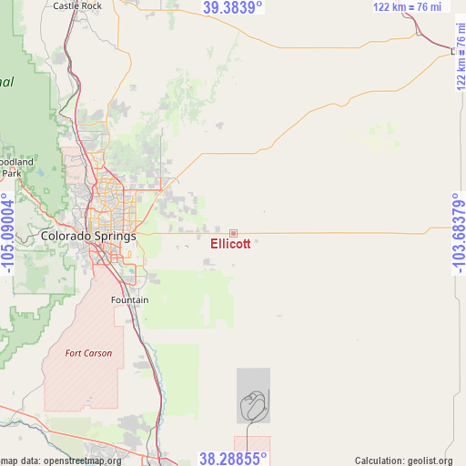
Ellicott GPS coordinates[2]
38° 50' 17.988" North, 104° 23' 12.876" West
| Map corner | latitude | longitude |
|---|---|---|
| Upper-left | 39.3839°, | -105.09004° |
| Center: | 38.83833°, | -104.38691° |
| Lower-right: | 38.28855°, | -103.68379° |
| Map W x H: | 121.8×121.8 km | = 75.7×75.7mi |
| max Lat: | 71.29058° ⇑56.3% North |
| Ellicott: | 38.83833° |
| min Lat: | ⇓43.7% South 19.06759° |
| min Long | Ellicott | max Long |
| -171.73463° | -104.38691° | -66.98998° |
| W 17.2%⇐ | ⇒82.8% E |
Elevation
Elevation of Ellicott is 1838 m = 6030 ft, and this is 1543.2 m = 5063 ft above average elevation for this country.
| Max E: |
3189 m = 10463 ft | 1.4% |
| Ellicott | 1838 m 6030 ft | |
| Avg. | 294.8 m = 967 ft | |
Min E: |
-60 m = -197 ft | 98.6% |
See also: United States elevation on elevation.city.
Geographical zone
Ellicott is located in North temperate zone (between Tropic of Cancer and the Arctic Circle). Distance of this Northern Tropic circle is 1712.5 km =1064.1 mi to South.| Distance of | km | miles | from Ellicott |
|---|---|---|---|
| North Pole | 5688.6 | 3534.7 | to North |
| Arctic Circle | 3082.8 | 1915.6 | to North |
| Tropic Cancer | 1712.5 | 1064.1 | to South |
| Equator | 4318.4 | 2683.3 | to South |


Nearby cities:
15 places around Ellicott: (largest is in red/bold)
• Air Force Academy
44.7 km =27.8 mi,  292°
292°
• Black Forest
33.4 km =20.8 mi,  305°
305°
• Calhan
23.3 km =14.5 mi,  19°
19°
• Cascade-Chipita Park
54.5 km =33.9 mi,  282°
282°
• Cimarron Hills
27.1 km =16.8 mi,  274°
274°
• Colorado Springs
37.6 km =23.4 mi, 269°
• Fort Carson
36.6 km =22.7 mi,  252°
252°
• Fountain
32.3 km =20.1 mi,  237°
237°
• Gleneagle
44.3 km =27.5 mi,  301°
301°
• Manitou Springs
46 km =28.6 mi, 272°
• Monument
50.6 km =31.4 mi, 303°
• Security-Widefield
30.1 km =18.7 mi, 250°
• Simla
42.7 km =26.5 mi,  37°
37°
• Stratmoor
34.8 km =21.6 mi,  258°
258°
• Woodmoor
49.4 km =30.7 mi, 306°
Sources, notices
• [Note1] Compared only with cities in United States existing in our database
• [Src1] Map data: © OpenStreetMap contributors (CC-BY-SA)
• [Src2] Other city data from geonames.org with taken over terms of usage.
• [Src3] Geographical zone / Annual Mean Temperature by Robert A. Rohde @ Wikipedia
