Spencerville geodata
Spencerville (New Mexico) is a populated place; located in United States in America/Denver (GMT-6) time zone. With population of 1,258 people, there are 14802 cities with bigger population in this country. Compared to other cities in United States, 66.8% of cities are located further ↑North; 85% of cities are located further →East and 98.1% of cities have lower elevation than Spencerville. Note1


Spencerville GPS coordinates[2]
36° 49' 12" North, 108° 3' 29.268" West
| Map corner | latitude | longitude |
|---|---|---|
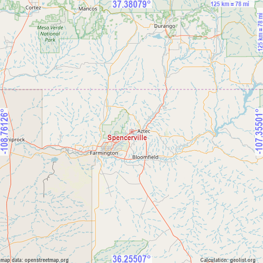
| Upper-left | 37.38079°, | -108.76126° |
| Center: | 36.82°, | -108.05813° |
| Lower-right: | 36.25507°, | -107.35501° |
| Map W x H: | 125.2×125.2 km | = 77.8×77.8mi |
| max Lat: | 71.29058° ⇑66.8% North |
| Spencerville: | 36.82° |
| min Lat: | ⇓33.2% South 19.06759° |
| min Long | Spencerville | max Long |
| -171.73463° | -108.05813° | -66.98998° |
| W 15%⇐ | ⇒85% E |
Elevation
Elevation of Spencerville is 1733 m = 5686 ft, and this is 1438.2 m = 4719 ft above average elevation for this country.
| Max E: |
3189 m = 10463 ft | 1.9% |
| Spencerville | 1733 m 5686 ft | |
| Avg. | 294.8 m = 967 ft | |
Min E: |
-60 m = -197 ft | 98.1% |
See also: United States elevation on elevation.city.
Geographical zone
Spencerville is located in North temperate zone (between Tropic of Cancer and the Arctic Circle). Distance of this Northern Tropic circle is 1488.1 km =924.7 mi to South.| Distance of | km | miles | from Spencerville |
|---|---|---|---|
| North Pole | 5913.1 | 3674.2 | to North |
| Arctic Circle | 3307.2 | 2055 | to North |
| Tropic Cancer | 1488.1 | 924.7 | to South |
| Equator | 4094 | 2543.9 | to South |


Nearby cities:
15 places around Spencerville: (largest is in red/bold)
• Aztec
5.8 km =3.6 mi,  87°
87°
• Bloomfield
13.8 km =8.6 mi,  151°
151°
• Cedar Hill
19.8 km =12.3 mi,  48°
48°
• Farmington
17.6 km =10.9 mi,  234°
234°
• Flora Vista
3.5 km =2.2 mi,  214°
214°
• Ignacio
50 km =31.1 mi, 49°
• Kirtland
28.5 km =17.7 mi,  250°
250°
• La Plata
16.9 km =10.5 mi,  315°
315°
• Lee Acres
13.6 km =8.5 mi,  171°
171°
• Napi Headquarters
23.5 km =14.6 mi,  217°
217°
• Nenahnezad
33.4 km =20.8 mi, 253°
• Ojo Amarillo
31.1 km =19.3 mi,  243°
243°
• Upper Fruitland
25.6 km =15.9 mi, 243°
• Waterflow
38.3 km =23.8 mi,  259°
259°
• West Hammond
15.5 km =9.6 mi,  177°
177°
Sources, notices
• [Note1] Compared only with cities in United States existing in our database
• [Src1] Map data: © OpenStreetMap contributors (CC-BY-SA)
• [Src2] Other city data from geonames.org with taken over terms of usage.
• [Src3] Geographical zone / Annual Mean Temperature by Robert A. Rohde @ Wikipedia
