Mount Shasta geodata
Mount Shasta (California) is a populated place; located in United States in America/Los_Angeles (GMT-7) time zone. With population of 3,296 people, there are 9157 cities with bigger population in this country. Compared to other cities in United States, 68.9% of cities are located further ↓South; 96.1% of cities are located further →East and 93.9% of cities have lower elevation than Mount Shasta. Note1


Mount Shasta GPS coordinates[2]
41° 18' 36.864" North, 122° 18' 44.1" West
| Map corner | latitude | longitude |
|---|---|---|
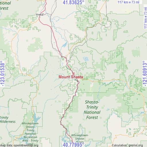
| Upper-left | 41.83625°, | -123.01538° |
| Center: | 41.31024°, | -122.31225° |
| Lower-right: | 40.77995°, | -121.60913° |
| Map W x H: | 117.4×117.4 km | = 72.9×72.9mi |
| max Lat: | 71.29058° ⇑31.1% North |
| Mount Shasta: | 41.31024° |
| min Lat: | ⇓68.9% South 19.06759° |
| min Long | Mount Shasta | max Long |
| -171.73463° | -122.31225° | -66.98998° |
| W 3.9%⇐ | ⇒96.1% E |
Elevation
Elevation of Mount Shasta is 1089 m = 3573 ft, and this is 794.2 m = 2606 ft above average elevation for this country.
| Max E: |
3189 m = 10463 ft | 6.1% |
| Mount Shasta | 1089 m 3573 ft | |
| Avg. | 294.8 m = 967 ft | |
Min E: |
-60 m = -197 ft | 93.9% |
See also: United States elevation on elevation.city.
Geographical zone
Mount Shasta is located in North temperate zone (between Tropic of Cancer and the Arctic Circle). Distance of this Northern Tropic circle is 1987.3 km =1234.9 mi to South.| Distance of | km | miles | from Mount Shasta |
|---|---|---|---|
| North Pole | 5413.8 | 3364 | to North |
| Arctic Circle | 2807.9 | 1744.7 | to North |
| Tropic Cancer | 1987.3 | 1234.9 | to South |
| Equator | 4593.3 | 2854.1 | to South |


Nearby cities:
15 places around Mount Shasta: (largest is in red/bold)
• Bella Vista
74.7 km =46.4 mi,  174°
174°
• Burney
72.4 km =45 mi,  131°
131°
• Central Valley (historical)
70.2 km =43.6 mi,  184°
184°
• Dorris
80.1 km =49.8 mi,  24°
24°
• Dunsmuir
11.8 km =7.3 mi,  163°
163°
• Etna
51.3 km =31.9 mi,  288°
288°
• Fort Jones
55 km =34.2 mi,  306°
306°
• Lewiston
78.9 km =49 mi,  211°
211°
• McCloud
15.7 km =9.8 mi,  112°
112°
• Montague
49.8 km =30.9 mi,  338°
338°
• Mountain Gate
66.1 km =41.1 mi, 181°
• Shasta
80.5 km =50 mi,  190°
190°
• Shasta Lake
70.2 km =43.6 mi, 184°
• Weed
13.9 km =8.6 mi,  333°
333°
• Yreka
54.4 km =33.8 mi, 330°
Sources, notices
• [Note1] Compared only with cities in United States existing in our database
• [Src1] Map data: © OpenStreetMap contributors (CC-BY-SA)
• [Src2] Other city data from geonames.org with taken over terms of usage.
• [Src3] Geographical zone / Annual Mean Temperature by Robert A. Rohde @ Wikipedia
