Blackfoot geodata
Blackfoot (Idaho) is a seat of a second-order administrative division; located in United States in America/Boise (GMT-6) time zone. With population of 11,740 people, there are 3958 cities with bigger population in this country. Compared to other cities in United States, 84.8% of cities are located further ↓South; 88% of cities are located further →East and 95.7% of cities have lower elevation than Blackfoot. Note1


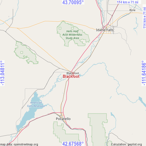
Blackfoot GPS coordinates[2]
43° 11' 25.692" North, 112° 20' 41.928" West
| Map corner | latitude | longitude |
|---|---|---|
| Upper-left | 43.70095°, | -113.04811° |
| Center: | 43.19047°, | -112.34498° |
| Lower-right: | 42.67568°, | -111.64186° |
| Map W x H: | 114×114 km | = 70.8×70.8mi |
| max Lat: | 71.29058° ⇑15.2% North |
| Blackfoot: | 43.19047° |
| min Lat: | ⇓84.8% South 19.06759° |
| min Long | Blackfoot | max Long |
| -171.73463° | -112.34498° | -66.98998° |
| W 12%⇐ | ⇒88% E |
Elevation
Elevation of Blackfoot is 1375 m = 4511 ft, and this is 1080.2 m = 3544 ft above average elevation for this country.
| Max E: |
3189 m = 10463 ft | 4.3% |
| Blackfoot | 1375 m 4511 ft | |
| Avg. | 294.8 m = 967 ft | |
Min E: |
-60 m = -197 ft | 95.7% |
See also: United States elevation on elevation.city.
Geographical zone
Blackfoot is located in North temperate zone (between Tropic of Cancer and the Arctic Circle). Distance of this Northern Tropic circle is 2196.4 km =1364.8 mi to South.| Distance of | km | miles | from Blackfoot |
|---|---|---|---|
| North Pole | 5204.7 | 3234 | to North |
| Arctic Circle | 2598.8 | 1614.8 | to North |
| Tropic Cancer | 2196.4 | 1364.8 | to South |
| Equator | 4802.3 | 2984 | to South |


Nearby cities:
15 places around Blackfoot: (largest is in red/bold)
• Aberdeen
48.5 km =30.1 mi,  235°
235°
• Ammon
43.6 km =27.1 mi,  44°
44°
• Arbon Valley
39.6 km =24.6 mi,  210°
210°
• Chubbuck
31.6 km =19.6 mi,  198°
198°
• Fort Hall
19.1 km =11.9 mi, 203°
• Groveland
4 km =2.5 mi,  325°
325°
• Idaho Falls
39.7 km =24.7 mi, 39°
• Inkom
44.4 km =27.6 mi,  170°
170°
• Iona
50 km =31.1 mi, 41°
• Lincoln
47.3 km =29.4 mi, 40°
• Moreland
8.7 km =5.4 mi,  294°
294°
• Pocatello
36.4 km =22.6 mi,  192°
192°
• Riverside
7.4 km =4.6 mi,  275°
275°
• Shelley
27.8 km =17.3 mi, 40°
• Tyhee
28.3 km =17.6 mi, 200°
Sources, notices
• [Note1] Compared only with cities in United States existing in our database
• [Src1] Map data: © OpenStreetMap contributors (CC-BY-SA)
• [Src2] Other city data from geonames.org with taken over terms of usage.
• [Src3] Geographical zone / Annual Mean Temperature by Robert A. Rohde @ Wikipedia
