Inkom geodata
Inkom (Idaho) is a populated place; located in United States in America/Boise (GMT-6) time zone. With population of 870 people, there are 17201 cities with bigger population in this country. Compared to other cities in United States, 81.9% of cities are located further ↓South; 87.9% of cities are located further →East and 95.9% of cities have lower elevation than Inkom. Note1


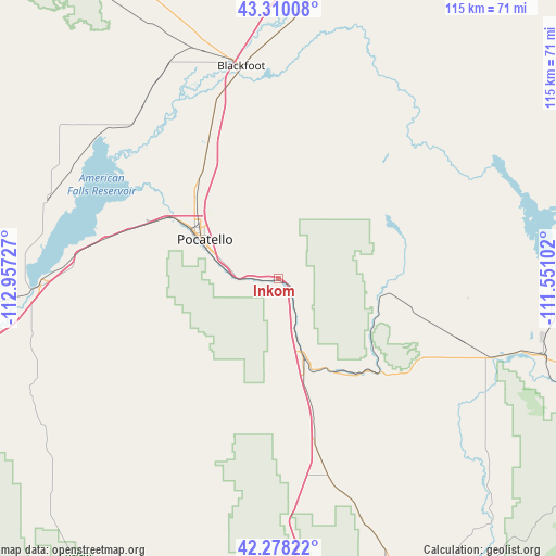
Inkom GPS coordinates[2]
42° 47' 46.68" North, 112° 15' 14.904" West
| Map corner | latitude | longitude |
|---|---|---|
| Upper-left | 43.31008°, | -112.95727° |
| Center: | 42.7963°, | -112.25414° |
| Lower-right: | 42.27822°, | -111.55102° |
| Map W x H: | 114.7×114.7 km | = 71.3×71.3mi |
| max Lat: | 71.29058° ⇑18.1% North |
| Inkom: | 42.7963° |
| min Lat: | ⇓81.9% South 19.06759° |
| min Long | Inkom | max Long |
| -171.73463° | -112.25414° | -66.98998° |
| W 12.1%⇐ | ⇒87.9% E |
Elevation
Elevation of Inkom is 1386 m = 4547 ft, and this is 1091.2 m = 3580 ft above average elevation for this country.
| Max E: |
3189 m = 10463 ft | 4.1% |
| Inkom | 1386 m 4547 ft | |
| Avg. | 294.8 m = 967 ft | |
Min E: |
-60 m = -197 ft | 95.9% |
See also: United States elevation on elevation.city.
Geographical zone
Inkom is located in North temperate zone (between Tropic of Cancer and the Arctic Circle). Distance of this Northern Tropic circle is 2152.6 km =1337.6 mi to South.| Distance of | km | miles | from Inkom |
|---|---|---|---|
| North Pole | 5248.6 | 3261.3 | to North |
| Arctic Circle | 2642.7 | 1642.1 | to North |
| Tropic Cancer | 2152.6 | 1337.6 | to South |
| Equator | 4758.5 | 2956.8 | to South |


Nearby cities:
15 places around Inkom: (largest is in red/bold)
• Aberdeen
50.4 km =31.3 mi,  289°
289°
• American Falls
49 km =30.4 mi,  268°
268°
• Arbon Valley
29.4 km =18.3 mi, 289°
• Blackfoot
44.4 km =27.6 mi,  350°
350°
• Chubbuck
22.1 km =13.7 mi,  308°
308°
• Downey
42.2 km =26.2 mi,  165°
165°
• Fort Hall
30.3 km =18.8 mi,  330°
330°
• Grace
49.3 km =30.6 mi,  119°
119°
• Groveland
48.1 km =29.9 mi, 348°
• McCammon
17 km =10.6 mi,  162°
162°
• Moreland
49.8 km =30.9 mi,  342°
342°
• Pocatello
17.7 km =11 mi,  298°
298°
• Riverside
46.9 km =29.1 mi, 341°
• Soda Springs
55.3 km =34.4 mi,  106°
106°
• Tyhee
24.4 km =15.2 mi, 314°
Sources, notices
• [Note1] Compared only with cities in United States existing in our database
• [Src1] Map data: © OpenStreetMap contributors (CC-BY-SA)
• [Src2] Other city data from geonames.org with taken over terms of usage.
• [Src3] Geographical zone / Annual Mean Temperature by Robert A. Rohde @ Wikipedia
