Kamiah geodata
Kamiah (Idaho) is a populated place; located in United States in America/Los_Angeles (GMT-7) time zone. With population of 1,273 people, there are 14718 cities with bigger population in this country. Compared to other cities in United States, 95.4% of cities are located further ↓South; 89.1% of cities are located further →East and 82% of cities have lower elevation than Kamiah. Note1


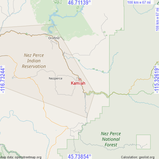
Kamiah GPS coordinates[2]
46° 13' 37.632" North, 116° 1' 45.516" West
| Map corner | latitude | longitude |
|---|---|---|
| Upper-left | 46.71139°, | -116.73244° |
| Center: | 46.22712°, | -116.02931° |
| Lower-right: | 45.73854°, | -115.32619° |
| Map W x H: | 108.2×108.2 km | = 67.2×67.2mi |
| max Lat: | 71.29058° ⇑4.6% North |
| Kamiah: | 46.22712° |
| min Lat: | ⇓95.4% South 19.06759° |
| min Long | Kamiah | max Long |
| -171.73463° | -116.02931° | -66.98998° |
| W 10.9%⇐ | ⇒89.1% E |
Elevation
Elevation of Kamiah is 376 m = 1234 ft, and this is 81.2 m = 266 ft above average elevation for this country.
| Max E: |
3189 m = 10463 ft | 18% |
| Kamiah | 376 m 1234 ft | |
| Avg. | 294.8 m = 967 ft | |
Min E: |
-60 m = -197 ft | 82% |
See also: United States elevation on elevation.city.
Geographical zone
Kamiah is located in North temperate zone (between Tropic of Cancer and the Arctic Circle). Distance of this North polar circle is 2261.2 km =1405 mi to North.| Distance of | km | miles | from Kamiah |
|---|---|---|---|
| North Pole | 4867.1 | 3024.3 | to North |
| Arctic Circle | 2261.2 | 1405 | to North |
| Tropic Cancer | 2534.1 | 1574.6 | to South |
| Equator | 5140 | 3193.8 | to South |


Nearby cities:
15 places around Kamiah: (largest is in red/bold)
• Asotin
79.3 km =49.3 mi,  279°
279°
• Clarkston
80.8 km =50.2 mi,  285°
285°
• Cottonwood
31.7 km =19.7 mi,  231°
231°
• Deary
75.3 km =46.8 mi,  327°
327°
• Genesee
77.6 km =48.2 mi,  297°
297°
• Grangeville
34.2 km =21.3 mi,  192°
192°
• Juliaetta
65 km =40.4 mi,  307°
307°
• Kooskia
10 km =6.2 mi,  156°
156°
• Lapwai
62.8 km =39 mi, 288°
• Lewiston
78.8 km =49 mi, 285°
• Lewiston Orchards
74.6 km =46.4 mi, 283°
• Nezperce
16.3 km =10.1 mi,  273°
273°
• Orofino
33 km =20.5 mi, 328°
• Troy
80.2 km =49.8 mi, 314°
• West Clarkston-Highland
81.8 km =50.8 mi, 283°
Sources, notices
• [Note1] Compared only with cities in United States existing in our database
• [Src1] Map data: © OpenStreetMap contributors (CC-BY-SA)
• [Src2] Other city data from geonames.org with taken over terms of usage.
• [Src3] Geographical zone / Annual Mean Temperature by Robert A. Rohde @ Wikipedia
