Hardin geodata
Hardin (Montana) is a seat of a second-order administrative division; located in United States in America/Denver (GMT-6) time zone. With population of 3,800 people, there are 8460 cities with bigger population in this country. Compared to other cities in United States, 94.6% of cities are located further ↓South; 84.9% of cities are located further →East and 92.6% of cities have lower elevation than Hardin. Note1


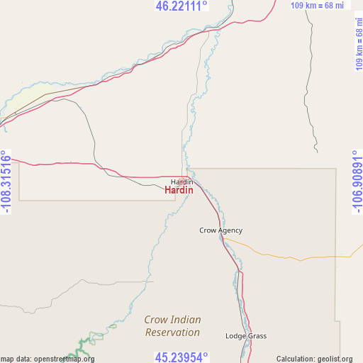
Hardin GPS coordinates[2]
45° 43' 56.928" North, 107° 36' 43.308" West
| Map corner | latitude | longitude |
|---|---|---|
| Upper-left | 46.22111°, | -108.31516° |
| Center: | 45.73248°, | -107.61203° |
| Lower-right: | 45.23954°, | -106.90891° |
| Map W x H: | 109.1×109.1 km | = 67.8×67.8mi |
| max Lat: | 71.29058° ⇑5.4% North |
| Hardin: | 45.73248° |
| min Lat: | ⇓94.6% South 19.06759° |
| min Long | Hardin | max Long |
| -171.73463° | -107.61203° | -66.98998° |
| W 15.1%⇐ | ⇒84.9% E |
Elevation
Elevation of Hardin is 886 m = 2907 ft, and this is 591.2 m = 1940 ft above average elevation for this country.
| Max E: |
3189 m = 10463 ft | 7.4% |
| Hardin | 886 m 2907 ft | |
| Avg. | 294.8 m = 967 ft | |
Min E: |
-60 m = -197 ft | 92.6% |
See also: United States elevation on elevation.city.
Geographical zone
Hardin is located in North temperate zone (between Tropic of Cancer and the Arctic Circle). Distance of this North polar circle is 2316.2 km =1439.2 mi to North.| Distance of | km | miles | from Hardin |
|---|---|---|---|
| North Pole | 4922.1 | 3058.5 | to North |
| Arctic Circle | 2316.2 | 1439.2 | to North |
| Tropic Cancer | 2479.1 | 1540.4 | to South |
| Equator | 5085 | 3159.7 | to South |


Nearby cities:
15 places around Hardin: (largest is in red/bold)
• Billings
69.2 km =43 mi,  274°
274°
• Busby
55.5 km =34.5 mi,  113°
113°
• Colstrip
78.4 km =48.7 mi,  77°
77°
• Crow Agency
18.7 km =11.6 mi,  141°
141°
• Dayton
99.2 km =61.6 mi,  163°
163°
• Forsyth
93.4 km =58 mi,  50°
50°
• Hysham
68.8 km =42.8 mi,  25°
25°
• Lame Deer
74.4 km =46.2 mi,  99°
99°
• Laurel
90.3 km =56.1 mi, 265°
• Lockwood
63 km =39.1 mi,  278°
278°
• Muddy
67.3 km =41.8 mi, 100°
• Pryor
79.2 km =49.2 mi,  244°
244°
• Ranchester
98.1 km =61 mi, 159°
• Shepherd
61.2 km =38 mi,  292°
292°
• Worden
49.5 km =30.8 mi,  300°
300°
Sources, notices
• [Note1] Compared only with cities in United States existing in our database
• [Src1] Map data: © OpenStreetMap contributors (CC-BY-SA)
• [Src2] Other city data from geonames.org with taken over terms of usage.
• [Src3] Geographical zone / Annual Mean Temperature by Robert A. Rohde @ Wikipedia
