Billings geodata
Billings (Montana) is a seat of a second-order administrative division; located in United States in America/Denver (GMT-6) time zone. With population of 110,263 people, there are 303 cities with bigger population in this country. Compared to other cities in United States, 94.7% of cities are located further ↓South; 85.2% of cities are located further →East and 93.1% of cities have lower elevation than Billings. Note1


Billings GPS coordinates[2]
45° 46' 59.844" North, 108° 30' 2.484" West
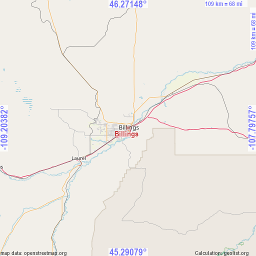
| Map corner | latitude | longitude |
|---|---|---|
| Upper-left | 46.27148°, | -109.20382° |
| Center: | 45.78329°, | -108.50069° |
| Lower-right: | 45.29079°, | -107.79757° |
| Map W x H: | 109×109 km | = 67.7×67.7mi |
| max Lat: | 71.29058° ⇑5.3% North |
| Billings: | 45.78329° |
| min Lat: | ⇓94.7% South 19.06759° |
| min Long | Billings | max Long |
| -171.73463° | -108.50069° | -66.98998° |
| W 14.8%⇐ | ⇒85.2% E |
Elevation
Elevation of Billings is 954 m = 3130 ft, and this is 659.2 m = 2163 ft above average elevation for this country.
| Max E: |
3189 m = 10463 ft | 6.9% |
| Billings | 954 m 3130 ft | |
| Avg. | 294.8 m = 967 ft | |
Min E: |
-60 m = -197 ft | 93.1% |
See also: Billings elevation on elevation.city.
Geographical zone
Billings is located in North temperate zone (between Tropic of Cancer and the Arctic Circle). Distance of this North polar circle is 2310.5 km =1435.7 mi to North.| Distance of | km | miles | from Billings |
|---|---|---|---|
| North Pole | 4916.4 | 3054.9 | to North |
| Arctic Circle | 2310.5 | 1435.7 | to North |
| Tropic Cancer | 2484.7 | 1543.9 | to South |
| Equator | 5090.6 | 3163.2 | to South |


Nearby cities:
15 places around Billings: (largest is in red/bold)
• Absarokee
78.8 km =49 mi,  248°
248°
• Bridger
63 km =39.1 mi,  210°
210°
• Columbus
60.6 km =37.7 mi, 254°
• Crow Agency
83.2 km =51.7 mi,  104°
104°
• Hardin
69.2 km =43 mi,  94°
94°
• Joliet
49.3 km =30.6 mi,  227°
227°
• Laurel
24.6 km =15.3 mi,  238°
238°
• Lockwood
7.8 km =4.8 mi,  59°
59°
• Park City
36.5 km =22.7 mi, 242°
• Pryor
39.4 km =24.5 mi,  183°
183°
• Red Lodge
88.3 km =54.9 mi,  221°
221°
• Roundup
73.7 km =45.8 mi,  357°
357°
• Ryegate
81.8 km =50.8 mi,  314°
314°
• Shepherd
21.6 km =13.4 mi,  34°
34°
• Worden
32.8 km =20.4 mi,  53°
53°
Sources, notices
• [Note1] Compared only with cities in United States existing in our database
• [Src1] Map data: © OpenStreetMap contributors (CC-BY-SA)
• [Src2] Other city data from geonames.org with taken over terms of usage.
• [Src3] Geographical zone / Annual Mean Temperature by Robert A. Rohde @ Wikipedia
