Stanford geodata
Stanford (Montana) is a seat of a second-order administrative division; located in United States in America/Denver (GMT-6) time zone. With population of 381 people, there are 20944 cities with bigger population in this country. Compared to other cities in United States, 96.9% of cities are located further ↓South; 85.9% of cities are located further →East and 95.2% of cities have lower elevation than Stanford. Note1


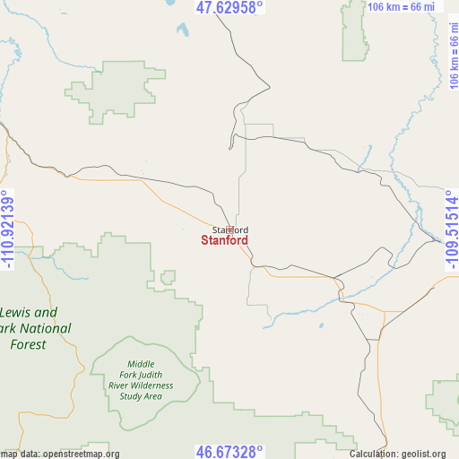
Stanford GPS coordinates[2]
47° 9' 12.888" North, 110° 13' 5.736" West
| Map corner | latitude | longitude |
|---|---|---|
| Upper-left | 47.62958°, | -110.92139° |
| Center: | 47.15358°, | -110.21826° |
| Lower-right: | 46.67328°, | -109.51514° |
| Map W x H: | 106.3×106.3 km | = 66.1×66.1mi |
| max Lat: | 71.29058° ⇑3.1% North |
| Stanford: | 47.15358° |
| min Lat: | ⇓96.9% South 19.06759° |
| min Long | Stanford | max Long |
| -171.73463° | -110.21826° | -66.98998° |
| W 14.1%⇐ | ⇒85.9% E |
Elevation
Elevation of Stanford is 1302 m = 4272 ft, and this is 1007.2 m = 3304 ft above average elevation for this country.
| Max E: |
3189 m = 10463 ft | 4.8% |
| Stanford | 1302 m 4272 ft | |
| Avg. | 294.8 m = 967 ft | |
Min E: |
-60 m = -197 ft | 95.2% |
See also: United States elevation on elevation.city.
Geographical zone
Stanford is located in North temperate zone (between Tropic of Cancer and the Arctic Circle). Distance of this North polar circle is 2158.2 km =1341 mi to North.| Distance of | km | miles | from Stanford |
|---|---|---|---|
| North Pole | 4764.1 | 2960.3 | to North |
| Arctic Circle | 2158.2 | 1341 | to North |
| Tropic Cancer | 2637.1 | 1638.6 | to South |
| Equator | 5243 | 3257.8 | to South |


Nearby cities:
15 places around Stanford: (largest is in red/bold)
• Belt
59.3 km =36.8 mi,  295°
295°
• Big Sandy
114.2 km =71 mi,  3°
3°
• Black Eagle
89.9 km =55.9 mi, 297°
• Cascade
112.7 km =70 mi,  276°
276°
• Fort Benton
81.3 km =50.5 mi,  335°
335°
• Great Falls
90.2 km =56 mi, 295°
• Harlowton
85 km =52.8 mi,  159°
159°
• Lewistown
60.6 km =37.7 mi,  99°
99°
• Malmstrom Air Force Base
82.6 km =51.3 mi, 298°
• Ryegate
120.1 km =74.6 mi,  142°
142°
• Sun Prairie
104.3 km =64.8 mi,  294°
294°
• The Silos
134.4 km =83.5 mi,  230°
230°
• Ulm
102 km =63.4 mi, 287°
• Vaughn
109.8 km =68.2 mi, 294°
• White Sulphur Springs
85.1 km =52.9 mi,  217°
217°
Sources, notices
• [Note1] Compared only with cities in United States existing in our database
• [Src1] Map data: © OpenStreetMap contributors (CC-BY-SA)
• [Src2] Other city data from geonames.org with taken over terms of usage.
• [Src3] Geographical zone / Annual Mean Temperature by Robert A. Rohde @ Wikipedia
