Linton geodata
Linton (North Dakota) is a seat of a second-order administrative division; located in United States in America/Chicago (GMT-5) time zone. With population of 1,039 people, there are 16030 cities with bigger population in this country. Compared to other cities in United States, 95.4% of cities are located further ↓South; 80.9% of cities are located further →East and 88.4% of cities have lower elevation than Linton. Note1


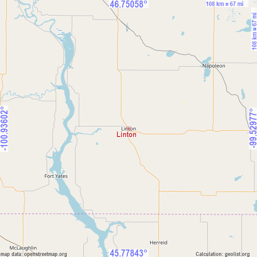
Linton GPS coordinates[2]
46° 15' 59.976" North, 100° 13' 58.404" West
| Map corner | latitude | longitude |
|---|---|---|
| Upper-left | 46.75058°, | -100.93602° |
| Center: | 46.26666°, | -100.23289° |
| Lower-right: | 45.77843°, | -99.52977° |
| Map W x H: | 108.1×108.1 km | = 67.2×67.2mi |
| max Lat: | 71.29058° ⇑4.6% North |
| Linton: | 46.26666° |
| min Lat: | ⇓95.4% South 19.06759° |
| min Long | Linton | max Long |
| -171.73463° | -100.23289° | -66.98998° |
| W 19.1%⇐ | ⇒80.9% E |
Elevation
Elevation of Linton is 524 m = 1719 ft, and this is 229.2 m = 752 ft above average elevation for this country.
| Max E: |
3189 m = 10463 ft | 11.6% |
| Linton | 524 m 1719 ft | |
| Avg. | 294.8 m = 967 ft | |
Min E: |
-60 m = -197 ft | 88.4% |
See also: United States elevation on elevation.city.
Geographical zone
Linton is located in North temperate zone (between Tropic of Cancer and the Arctic Circle). Distance of this North polar circle is 2256.8 km =1402.3 mi to North.| Distance of | km | miles | from Linton |
|---|---|---|---|
| North Pole | 4862.7 | 3021.5 | to North |
| Arctic Circle | 2256.8 | 1402.3 | to North |
| Tropic Cancer | 2538.5 | 1577.4 | to South |
| Equator | 5144.4 | 3196.6 | to South |


Nearby cities:
15 places around Linton: (largest is in red/bold)
• Ashley
71.2 km =44.2 mi,  111°
111°
• Bismarck
73.5 km =45.7 mi,  325°
325°
• Cannon Ball
30.9 km =19.2 mi,  296°
296°
• Eureka
72.8 km =45.2 mi,  139°
139°
• Fort Yates
36.5 km =22.7 mi,  236°
236°
• Lincoln
65.7 km =40.8 mi, 327°
• Mandan
80 km =49.7 mi,  321°
321°
• McIntosh
94.3 km =58.6 mi,  245°
245°
• McLaughlin
67.2 km =41.8 mi,  221°
221°
• Mobridge
82.5 km =51.3 mi,  190°
190°
• Mound City
61.5 km =38.2 mi,  168°
168°
• Napoleon
44.4 km =27.6 mi,  52°
52°
• Selby
86 km =53.4 mi, 169°
• Steele
69.7 km =43.3 mi,  20°
20°
• Wishek
52 km =32.3 mi,  91°
91°
Sources, notices
• [Note1] Compared only with cities in United States existing in our database
• [Src1] Map data: © OpenStreetMap contributors (CC-BY-SA)
• [Src2] Other city data from geonames.org with taken over terms of usage.
• [Src3] Geographical zone / Annual Mean Temperature by Robert A. Rohde @ Wikipedia
