Steele geodata
Steele (North Dakota) is a seat of a second-order administrative division; located in United States in America/Chicago (GMT-5) time zone. With population of 709 people, there are 18587 cities with bigger population in this country. Compared to other cities in United States, 96.4% of cities are located further ↓South; 80.7% of cities are located further →East and 89.1% of cities have lower elevation than Steele. Note1


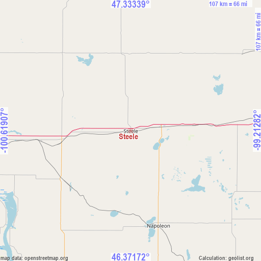
Steele GPS coordinates[2]
46° 51' 16.956" North, 99° 54' 57.384" West
| Map corner | latitude | longitude |
|---|---|---|
| Upper-left | 47.33339°, | -100.61907° |
| Center: | 46.85471°, | -99.91594° |
| Lower-right: | 46.37172°, | -99.21282° |
| Map W x H: | 106.9×106.9 km | = 66.4×66.4mi |
| max Lat: | 71.29058° ⇑3.6% North |
| Steele: | 46.85471° |
| min Lat: | ⇓96.4% South 19.06759° |
| min Long | Steele | max Long |
| -171.73463° | -99.91594° | -66.98998° |
| W 19.3%⇐ | ⇒80.7% E |
Elevation
Elevation of Steele is 565 m = 1854 ft, and this is 270.2 m = 886 ft above average elevation for this country.
| Max E: |
3189 m = 10463 ft | 10.9% |
| Steele | 565 m 1854 ft | |
| Avg. | 294.8 m = 967 ft | |
Min E: |
-60 m = -197 ft | 89.1% |
See also: United States elevation on elevation.city.
Geographical zone
Steele is located in North temperate zone (between Tropic of Cancer and the Arctic Circle). Distance of this North polar circle is 2191.4 km =1361.7 mi to North.| Distance of | km | miles | from Steele |
|---|---|---|---|
| North Pole | 4797.3 | 2980.9 | to North |
| Arctic Circle | 2191.4 | 1361.7 | to North |
| Tropic Cancer | 2603.8 | 1617.9 | to South |
| Equator | 5209.8 | 3237.2 | to South |


Nearby cities:
15 places around Steele: (largest is in red/bold)
• Ashley
100.3 km =62.3 mi,  155°
155°
• Bismarck
66.2 km =41.1 mi,  265°
265°
• Cannon Ball
73.2 km =45.5 mi,  225°
225°
• Carrington
89.1 km =55.4 mi,  42°
42°
• Fessenden
90.9 km =56.5 mi,  13°
13°
• Fort Yates
101.4 km =63 mi,  212°
212°
• Jamestown
92 km =57.2 mi,  86°
86°
• Lincoln
60.6 km =37.7 mi,  260°
260°
• Linton
69.7 km =43.3 mi,  200°
200°
• Mandan
74.1 km =46 mi, 267°
• McClusky
80.7 km =50.1 mi,  330°
330°
• Napoleon
40.1 km =24.9 mi, 164°
• Washburn
97.2 km =60.4 mi,  299°
299°
• Wilton
73.9 km =45.9 mi, 297°
• Wishek
71.9 km =44.7 mi, 157°
Sources, notices
• [Note1] Compared only with cities in United States existing in our database
• [Src1] Map data: © OpenStreetMap contributors (CC-BY-SA)
• [Src2] Other city data from geonames.org with taken over terms of usage.
• [Src3] Geographical zone / Annual Mean Temperature by Robert A. Rohde @ Wikipedia
