Stockville geodata
Stockville (Nebraska) is a seat of a second-order administrative division; located in United States in America/Chicago (GMT-5) time zone. With population of 24 people, there are 21052 cities with bigger population in this country. Compared to other cities in United States, 59.2% of cities are located further ↓South; 80.9% of cities are located further →East and 91.6% of cities have lower elevation than Stockville. Note1


Stockville GPS coordinates[2]
40° 31' 58.044" North, 100° 23' 0.528" West
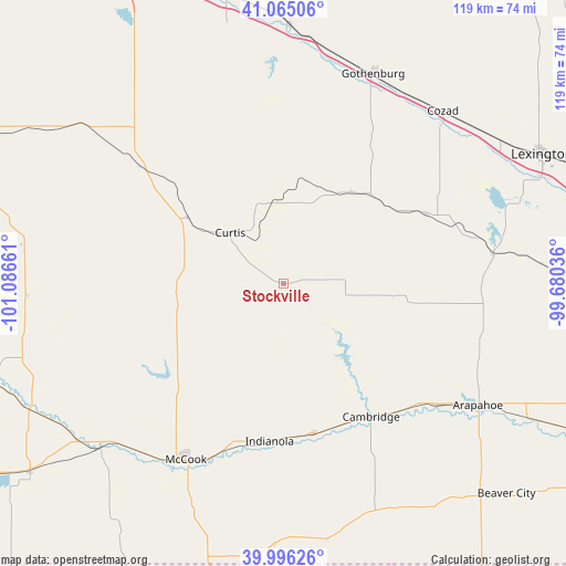
| Map corner | latitude | longitude |
|---|---|---|
| Upper-left | 41.06506°, | -101.08661° |
| Center: | 40.53279°, | -100.38348° |
| Lower-right: | 39.99626°, | -99.68036° |
| Map W x H: | 118.8×118.8 km | = 73.8×73.8mi |
| max Lat: | 71.29058° ⇑40.8% North |
| Stockville: | 40.53279° |
| min Lat: | ⇓59.2% South 19.06759° |
| min Long | Stockville | max Long |
| -171.73463° | -100.38348° | -66.98998° |
| W 19.1%⇐ | ⇒80.9% E |
Elevation
Elevation of Stockville is 762 m = 2500 ft, and this is 467.2 m = 1533 ft above average elevation for this country.
| Max E: |
3189 m = 10463 ft | 8.4% |
| Stockville | 762 m 2500 ft | |
| Avg. | 294.8 m = 967 ft | |
Min E: |
-60 m = -197 ft | 91.6% |
See also: United States elevation on elevation.city.
Geographical zone
Stockville is located in North temperate zone (between Tropic of Cancer and the Arctic Circle). Distance of this Northern Tropic circle is 1900.9 km =1181.2 mi to South.| Distance of | km | miles | from Stockville |
|---|---|---|---|
| North Pole | 5500.2 | 3417.7 | to North |
| Arctic Circle | 2894.4 | 1798.5 | to North |
| Tropic Cancer | 1900.9 | 1181.2 | to South |
| Equator | 4506.8 | 2800.4 | to South |


Nearby cities:
15 places around Stockville: (largest is in red/bold)
• Arapahoe
48.2 km =30 mi,  121°
121°
• Beaver City
64.3 km =40 mi,  133°
133°
• Bertrand
63.4 km =39.4 mi,  90°
90°
• Cambridge
33.4 km =20.8 mi,  146°
146°
• Cozad
49.4 km =30.7 mi,  42°
42°
• Culbertson
51.2 km =31.8 mi,  228°
228°
• Curtis
15.5 km =9.6 mi,  314°
314°
• Elwood
44.6 km =27.7 mi,  81°
81°
• Gothenburg
47.9 km =29.8 mi,  23°
23°
• Hayes Center
53.8 km =33.4 mi,  267°
267°
• Indianola
33.3 km =20.7 mi,  184°
184°
• Lexington
60.8 km =37.8 mi,  63°
63°
• McCook
42.1 km =26.2 mi,  209°
209°
• Oxford
71 km =44.1 mi, 116°
• Trenton
66.5 km =41.3 mi, 233°
Sources, notices
• [Note1] Compared only with cities in United States existing in our database
• [Src1] Map data: © OpenStreetMap contributors (CC-BY-SA)
• [Src2] Other city data from geonames.org with taken over terms of usage.
• [Src3] Geographical zone / Annual Mean Temperature by Robert A. Rohde @ Wikipedia
