Gresham geodata
Gresham (Oregon) is a populated place; located in United States in America/Los_Angeles (GMT-7) time zone. With population of 110,553 people, there are 299 cities with bigger population in this country. Compared to other cities in United States, 94% of cities are located further ↓South; 96.4% of cities are located further →East and 70.8% of cities have higher elevation than Gresham. Note1


Gresham GPS coordinates[2]
45° 29' 53.448" North, 122° 25' 53.328" West
| Map corner | latitude | longitude |
|---|---|---|
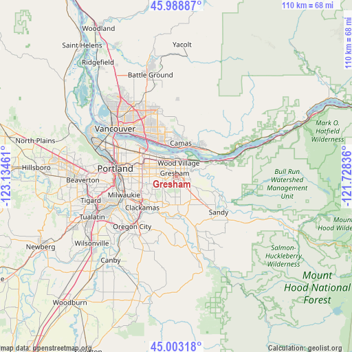
| Upper-left | 45.98887°, | -123.13461° |
| Center: | 45.49818°, | -122.43148° |
| Lower-right: | 45.00318°, | -121.72836° |
| Map W x H: | 109.6×109.6 km | = 68.1×68.1mi |
| max Lat: | 71.29058° ⇑6% North |
| Gresham: | 45.49818° |
| min Lat: | ⇓94% South 19.06759° |
| min Long | Gresham | max Long |
| -171.73463° | -122.43148° | -66.98998° |
| W 3.6%⇐ | ⇒96.4% E |
Elevation
Elevation of Gresham is 96 m = 315 ft, and this is 198.8 m = 652 ft below average elevation for this country.
| Max E: |
3189 m = 10463 ft | 70.8% |
| Avg. | 294.8 m = 967 ft | |
| Gresham | 96 m = 315 ft | |
Min E: |
-60 m = -197 ft | 29.2% |
See also: Gresham elevation on elevation.city.
Geographical zone
Gresham is located in North temperate zone (between Tropic of Cancer and the Arctic Circle). Distance of this North polar circle is 2342.3 km =1455.4 mi to North.| Distance of | km | miles | from Gresham |
|---|---|---|---|
| North Pole | 4948.1 | 3074.6 | to North |
| Arctic Circle | 2342.3 | 1455.4 | to North |
| Tropic Cancer | 2453 | 1524.2 | to South |
| Equator | 5058.9 | 3143.5 | to South |


Nearby cities:
15 places around Gresham: (largest is in red/bold)
• Camas
10.2 km =6.3 mi,  14°
14°
• Clackamas
14.8 km =9.2 mi,  227°
227°
• Damascus
9.2 km =5.7 mi,  193°
193°
• Fairview
4.5 km =2.8 mi,  357°
357°
• Fern Prairie
15.6 km =9.7 mi, 9°
• Happy Valley
9.6 km =6 mi, 233°
• Johnson City
15.5 km =9.6 mi, 227°
• Lents
10.8 km =6.7 mi,  259°
259°
• Maywood Park
11.7 km =7.3 mi,  301°
301°
• Mill Plain
16.8 km =10.4 mi,  343°
343°
• Milwaukie
17.2 km =10.7 mi,  250°
250°
• Oatfield
16.1 km =10 mi, 234°
• Troutdale
5.7 km =3.5 mi,  36°
36°
• Washougal
11.2 km =7 mi,  32°
32°
• Wood Village
4.1 km =2.5 mi, 13°
Sources, notices
• [Note1] Compared only with cities in United States existing in our database
• [Src1] Map data: © OpenStreetMap contributors (CC-BY-SA)
• [Src2] Other city data from geonames.org with taken over terms of usage.
• [Src3] Geographical zone / Annual Mean Temperature by Robert A. Rohde @ Wikipedia
