Wanblee geodata
Wanblee (South Dakota) is a populated place; located in United States in America/Denver (GMT-6) time zone. With population of 725 people, there are 18450 cities with bigger population in this country. Compared to other cities in United States, 86.6% of cities are located further ↓South; 81.6% of cities are located further →East and 92.1% of cities have lower elevation than Wanblee. Note1
Administrative division(s):
- Level 1: South Dakota
- Level 2: Jackson County
- Level 3: Unorganized Territory of Southwest Jackson


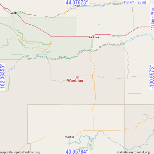
Wanblee GPS coordinates[2]
43° 34' 9.984" North, 101° 39' 37.512" West
| Map corner | latitude | longitude |
|---|---|---|
| Upper-left | 44.07673°, | -102.36355° |
| Center: | 43.56944°, | -101.66042° |
| Lower-right: | 43.05784°, | -100.9573° |
| Map W x H: | 113.3×113.3 km | = 70.4×70.4mi |
| max Lat: | 71.29058° ⇑13.4% North |
| Wanblee: | 43.56944° |
| min Lat: | ⇓86.6% South 19.06759° |
| min Long | Wanblee | max Long |
| -171.73463° | -101.66042° | -66.98998° |
| W 18.4%⇐ | ⇒81.6% E |
Elevation
Elevation of Wanblee is 804 m = 2638 ft, and this is 509.2 m = 1671 ft above average elevation for this country.
| Max E: |
3189 m = 10463 ft | 7.9% |
| Wanblee | 804 m 2638 ft | |
| Avg. | 294.8 m = 967 ft | |
Min E: |
-60 m = -197 ft | 92.1% |
See also: United States elevation on elevation.city.
Geographical zone
Wanblee is located in North temperate zone (between Tropic of Cancer and the Arctic Circle). Distance of this Northern Tropic circle is 2238.5 km =1390.9 mi to South.| Distance of | km | miles | from Wanblee |
|---|---|---|---|
| North Pole | 5162.6 | 3207.9 | to North |
| Arctic Circle | 2556.7 | 1588.7 | to North |
| Tropic Cancer | 2238.5 | 1390.9 | to South |
| Equator | 4844.5 | 3010.2 | to South |


Nearby cities:
15 places around Wanblee: (largest is in red/bold)
• Antelope
88.4 km =54.9 mi,  109°
109°
• Kadoka
31.8 km =19.8 mi,  22°
22°
• Kyle
44.6 km =27.7 mi,  248°
248°
• Manderson-White Horse Creek
76.7 km =47.7 mi,  241°
241°
• Martin
44.5 km =27.7 mi,  187°
187°
• Mission
86.1 km =53.5 mi, 109°
• Murdo
84 km =52.2 mi,  65°
65°
• Parmelee
58 km =36 mi,  118°
118°
• Philip
52.3 km =32.5 mi,  359°
359°
• Pine Ridge
94.4 km =58.7 mi,  230°
230°
• Porcupine
65.4 km =40.6 mi, 235°
• Rosebud
75.2 km =46.7 mi, 119°
• Saint Francis
77.2 km =48 mi,  127°
127°
• Wall
66.2 km =41.1 mi,  315°
315°
• White River
73.7 km =45.8 mi,  90°
90°
Sources, notices
• [Note1] Compared only with cities in United States existing in our database
• [Src1] Map data: © OpenStreetMap contributors (CC-BY-SA)
• [Src2] Other city data from geonames.org with taken over terms of usage.
• [Src3] Geographical zone / Annual Mean Temperature by Robert A. Rohde @ Wikipedia
