Amalga geodata
Amalga (Utah) is a populated place; located in United States in America/Denver (GMT-6) time zone. With population of 514 people, there are 20706 cities with bigger population in this country. Compared to other cities in United States, 74.4% of cities are located further ↓South; 87.2% of cities are located further →East and 95.6% of cities have lower elevation than Amalga. Note1


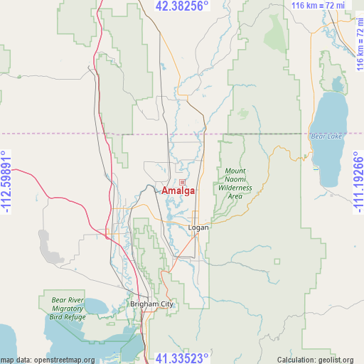
Amalga GPS coordinates[2]
41° 51' 39.744" North, 111° 53' 44.808" West
| Map corner | latitude | longitude |
|---|---|---|
| Upper-left | 42.38256°, | -112.59891° |
| Center: | 41.86104°, | -111.89578° |
| Lower-right: | 41.33523°, | -111.19266° |
| Map W x H: | 116.5×116.5 km | = 72.4×72.4mi |
| max Lat: | 71.29058° ⇑25.6% North |
| Amalga: | 41.86104° |
| min Lat: | ⇓74.4% South 19.06759° |
| min Long | Amalga | max Long |
| -171.73463° | -111.89578° | -66.98998° |
| W 12.8%⇐ | ⇒87.2% E |
Elevation
Elevation of Amalga is 1352 m = 4436 ft, and this is 1057.2 m = 3469 ft above average elevation for this country.
| Max E: |
3189 m = 10463 ft | 4.4% |
| Amalga | 1352 m 4436 ft | |
| Avg. | 294.8 m = 967 ft | |
Min E: |
-60 m = -197 ft | 95.6% |
See also: United States elevation on elevation.city.
Geographical zone
Amalga is located in North temperate zone (between Tropic of Cancer and the Arctic Circle). Distance of this Northern Tropic circle is 2048.6 km =1272.9 mi to South.| Distance of | km | miles | from Amalga |
|---|---|---|---|
| North Pole | 5352.6 | 3326 | to North |
| Arctic Circle | 2746.7 | 1706.7 | to North |
| Tropic Cancer | 2048.6 | 1272.9 | to South |
| Equator | 4654.5 | 2892.2 | to South |


Nearby cities:
15 places around Amalga: (largest is in red/bold)
• Benson
8.7 km =5.4 mi,  199°
199°
• Clarkston
14.4 km =8.9 mi,  297°
297°
• Franklin
18.5 km =11.5 mi,  23°
23°
• Hyde Park
9.4 km =5.8 mi,  137°
137°
• Lewiston
13.2 km =8.2 mi,  14°
14°
• Logan
14.9 km =9.3 mi,  159°
159°
• Mendon
18.1 km =11.2 mi, 202°
• Millville
20.8 km =12.9 mi, 163°
• Newton
7.9 km =4.9 mi,  271°
271°
• North Logan
12.7 km =7.9 mi, 143°
• Providence
18.4 km =11.4 mi, 159°
• Richmond
9.7 km =6 mi,  44°
44°
• River Heights
16.7 km =10.4 mi, 158°
• Smithfield
5.8 km =3.6 mi,  115°
115°
• Trenton
7.4 km =4.6 mi,  328°
328°
Sources, notices
• [Note1] Compared only with cities in United States existing in our database
• [Src1] Map data: © OpenStreetMap contributors (CC-BY-SA)
• [Src2] Other city data from geonames.org with taken over terms of usage.
• [Src3] Geographical zone / Annual Mean Temperature by Robert A. Rohde @ Wikipedia
