Corinne geodata
Corinne (Utah) is a populated place; located in United States in America/Denver (GMT-6) time zone. With population of 694 people, there are 18733 cities with bigger population in this country. Compared to other cities in United States, 71.4% of cities are located further ↓South; 87.7% of cities are located further →East and 95.1% of cities have lower elevation than Corinne. Note1


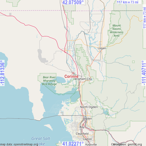
Corinne GPS coordinates[2]
41° 33' 3.744" North, 112° 6' 36.828" West
| Map corner | latitude | longitude |
|---|---|---|
| Upper-left | 42.07509°, | -112.81336° |
| Center: | 41.55104°, | -112.11023° |
| Lower-right: | 41.02271°, | -111.40711° |
| Map W x H: | 117×117 km | = 72.7×72.7mi |
| max Lat: | 71.29058° ⇑28.6% North |
| Corinne: | 41.55104° |
| min Lat: | ⇓71.4% South 19.06759° |
| min Long | Corinne | max Long |
| -171.73463° | -112.11023° | -66.98998° |
| W 12.3%⇐ | ⇒87.7% E |
Elevation
Elevation of Corinne is 1292 m = 4239 ft, and this is 997.2 m = 3272 ft above average elevation for this country.
| Max E: |
3189 m = 10463 ft | 4.9% |
| Corinne | 1292 m 4239 ft | |
| Avg. | 294.8 m = 967 ft | |
Min E: |
-60 m = -197 ft | 95.1% |
See also: United States elevation on elevation.city.
Geographical zone
Corinne is located in North temperate zone (between Tropic of Cancer and the Arctic Circle). Distance of this Northern Tropic circle is 2014.1 km =1251.5 mi to South.| Distance of | km | miles | from Corinne |
|---|---|---|---|
| North Pole | 5387 | 3347.3 | to North |
| Arctic Circle | 2781.1 | 1728.1 | to North |
| Tropic Cancer | 2014.1 | 1251.5 | to South |
| Equator | 4620 | 2870.7 | to South |


Nearby cities:
15 places around Corinne: (largest is in red/bold)
• Bear River City
7.2 km =4.5 mi,  349°
349°
• Brigham City
9.1 km =5.7 mi,  119°
119°
• Elwood
15.7 km =9.8 mi, 350°
• Garland
21.6 km =13.4 mi, 348°
• Honeyville
10.1 km =6.3 mi,  14°
14°
• Hyrum
23.4 km =14.5 mi,  66°
66°
• Mantua
15.2 km =9.4 mi,  113°
113°
• Mendon
20.8 km =12.9 mi,  31°
31°
• Paradise
22.7 km =14.1 mi,  85°
85°
• Perry
11.6 km =7.2 mi,  145°
145°
• South Willard
21.8 km =13.5 mi,  163°
163°
• Thatcher
22 km =13.7 mi,  316°
316°
• Tremonton
18.5 km =11.5 mi, 345°
• Wellsville
17.6 km =10.9 mi,  56°
56°
• Willard
16.9 km =10.5 mi, 158°
Sources, notices
• [Note1] Compared only with cities in United States existing in our database
• [Src1] Map data: © OpenStreetMap contributors (CC-BY-SA)
• [Src2] Other city data from geonames.org with taken over terms of usage.
• [Src3] Geographical zone / Annual Mean Temperature by Robert A. Rohde @ Wikipedia
