Dallesport geodata
Dallesport (Washington) is a populated place; located in United States in America/Los_Angeles (GMT-7) time zone. With population of 1,202 people, there are 15122 cities with bigger population in this country. Compared to other cities in United States, 94.3% of cities are located further ↓South; 94% of cities are located further →East and 76.2% of cities have higher elevation than Dallesport. Note1


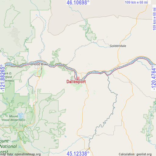
Dallesport GPS coordinates[2]
45° 37' 2.424" North, 121° 10' 46.272" West
| Map corner | latitude | longitude |
|---|---|---|
| Upper-left | 46.10698°, | -121.88265° |
| Center: | 45.61734°, | -121.17952° |
| Lower-right: | 45.12338°, | -120.4764° |
| Map W x H: | 109.4×109.4 km | = 68×68mi |
| max Lat: | 71.29058° ⇑5.7% North |
| Dallesport: | 45.61734° |
| min Lat: | ⇓94.3% South 19.06759° |
| min Long | Dallesport | max Long |
| -171.73463° | -121.17952° | -66.98998° |
| W 6%⇐ | ⇒94% E |
Elevation
Elevation of Dallesport is 65 m = 213 ft, and this is 229.8 m = 754 ft below average elevation for this country.
| Max E: |
3189 m = 10463 ft | 76.2% |
| Avg. | 294.8 m = 967 ft | |
| Dallesport | 65 m = 213 ft | |
Min E: |
-60 m = -197 ft | 23.8% |
See also: United States elevation on elevation.city.
Geographical zone
Dallesport is located in North temperate zone (between Tropic of Cancer and the Arctic Circle). Distance of this North polar circle is 2329 km =1447.2 mi to North.| Distance of | km | miles | from Dallesport |
|---|---|---|---|
| North Pole | 4934.9 | 3066.4 | to North |
| Arctic Circle | 2329 | 1447.2 | to North |
| Tropic Cancer | 2466.3 | 1532.5 | to South |
| Equator | 5072.2 | 3151.7 | to South |


Nearby cities:
15 places around Dallesport: (largest is in red/bold)
• Bingen
24.7 km =15.3 mi,  296°
296°
• Carson
51.1 km =31.8 mi,  283°
283°
• Cascade Locks
55.6 km =34.5 mi, 276°
• Chenoweth
5.1 km =3.2 mi, 282°
• Dufur
18.6 km =11.6 mi,  168°
168°
• Goldendale
35.8 km =22.2 mi,  50°
50°
• Hood River
28.3 km =17.6 mi,  290°
290°
• Moro
37.9 km =23.5 mi,  113°
113°
• Mount Hood Village
68.9 km =42.8 mi,  244°
244°
• North Bonneville
61.6 km =38.3 mi,  272°
272°
• Odell
28.3 km =17.6 mi, 272°
• Stevenson
55.5 km =34.5 mi, 279°
• The Dalles
2.5 km =1.6 mi,  178°
178°
• Trout Lake
50.2 km =31.2 mi,  327°
327°
• White Salmon
26.8 km =16.7 mi, 297°
Sources, notices
• [Note1] Compared only with cities in United States existing in our database
• [Src1] Map data: © OpenStreetMap contributors (CC-BY-SA)
• [Src2] Other city data from geonames.org with taken over terms of usage.
• [Src3] Geographical zone / Annual Mean Temperature by Robert A. Rohde @ Wikipedia
