Mount Hood Village geodata
Mount Hood Village (Oregon) is a populated place; located in United States in America/Los_Angeles (GMT-7) time zone. With population of 4,864 people, there are 7302 cities with bigger population in this country. Compared to other cities in United States, 93.6% of cities are located further ↓South; 95% of cities are located further →East and 83.2% of cities have lower elevation than Mount Hood Village. Note1


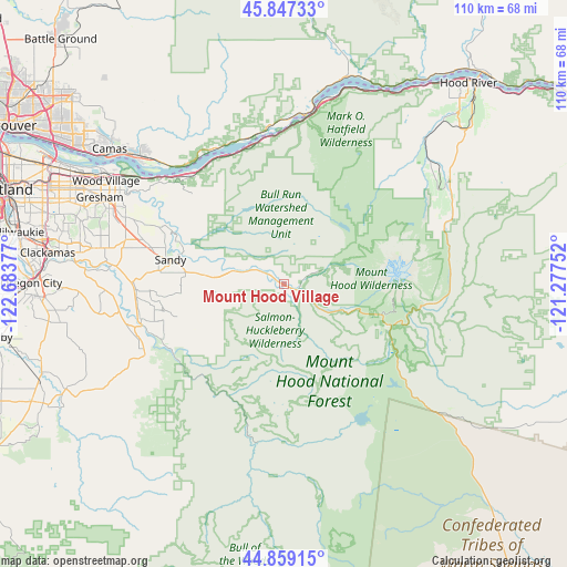
Mount Hood Village GPS coordinates[2]
45° 21' 19.44" North, 121° 58' 50.304" West
| Map corner | latitude | longitude |
|---|---|---|
| Upper-left | 45.84733°, | -122.68377° |
| Center: | 45.3554°, | -121.98064° |
| Lower-right: | 44.85915°, | -121.27752° |
| Map W x H: | 109.9×109.9 km | = 68.3×68.3mi |
| max Lat: | 71.29058° ⇑6.4% North |
| Mount Hood Village: | 45.3554° |
| min Lat: | ⇓93.6% South 19.06759° |
| min Long | Mount Hood Vill | max Long |
| -171.73463° | -121.98064° | -66.98998° |
| W 5%⇐ | ⇒95% E |
Elevation
Elevation of Mount Hood Village is 393 m = 1289 ft, and this is 98.2 m = 322 ft above average elevation for this country.
| Max E: |
3189 m = 10463 ft | 16.8% |
| Mount Hood Village | 393 m 1289 ft | |
| Avg. | 294.8 m = 967 ft | |
Min E: |
-60 m = -197 ft | 83.2% |
See also: United States elevation on elevation.city.
Geographical zone
Mount Hood Village is located in North temperate zone (between Tropic of Cancer and the Arctic Circle). Distance of this North polar circle is 2358.1 km =1465.3 mi to North.| Distance of | km | miles | from Mount Hood Village |
|---|---|---|---|
| North Pole | 4964 | 3084.5 | to North |
| Arctic Circle | 2358.1 | 1465.3 | to North |
| Tropic Cancer | 2437.1 | 1514.3 | to South |
| Equator | 5043 | 3133.6 | to South |


Nearby cities:
15 places around Mount Hood Village: (largest is in red/bold)
• Beavercreek
44 km =27.3 mi,  260°
260°
• Camas
41.6 km =25.8 mi,  308°
308°
• Carson
43 km =26.7 mi,  16°
16°
• Cascade Locks
35.7 km =22.2 mi,  11°
11°
• Damascus
38 km =23.6 mi,  280°
280°
• Estacada
28.6 km =17.8 mi, 255°
• Fairview
40.8 km =25.4 mi,  299°
299°
• Gresham
38.6 km =24 mi,  294°
294°
• Happy Valley
44.1 km =27.4 mi, 283°
• North Bonneville
31.4 km =19.5 mi,  1°
1°
• Sandy
22.4 km =13.9 mi, 282°
• Stevenson
38.6 km =24 mi, 11°
• Troutdale
37.7 km =23.4 mi, 302°
• Washougal
38.5 km =23.9 mi, 310°
• Wood Village
39.5 km =24.5 mi, 300°
Sources, notices
• [Note1] Compared only with cities in United States existing in our database
• [Src1] Map data: © OpenStreetMap contributors (CC-BY-SA)
• [Src2] Other city data from geonames.org with taken over terms of usage.
• [Src3] Geographical zone / Annual Mean Temperature by Robert A. Rohde @ Wikipedia
