Arapahoe geodata
Arapahoe (Wyoming) is a populated place; located in United States in America/Denver (GMT-6) time zone. With population of 1,656 people, there are 13063 cities with bigger population in this country. Compared to other cities in United States, 83% of cities are located further ↓South; 85.2% of cities are located further →East and 97% of cities have lower elevation than Arapahoe. Note1


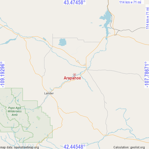
Arapahoe GPS coordinates[2]
42° 57' 43.848" North, 108° 29' 23.388" West
| Map corner | latitude | longitude |
|---|---|---|
| Upper-left | 43.47458°, | -109.19296° |
| Center: | 42.96218°, | -108.48983° |
| Lower-right: | 42.44548°, | -107.78671° |
| Map W x H: | 114.4×114.4 km | = 71.1×71.1mi |
| max Lat: | 71.29058° ⇑17% North |
| Arapahoe: | 42.96218° |
| min Lat: | ⇓83% South 19.06759° |
| min Long | Arapahoe | max Long |
| -171.73463° | -108.48983° | -66.98998° |
| W 14.8%⇐ | ⇒85.2% E |
Elevation
Elevation of Arapahoe is 1533 m = 5030 ft, and this is 1238.2 m = 4062 ft above average elevation for this country.
| Max E: |
3189 m = 10463 ft | 3% |
| Arapahoe | 1533 m 5030 ft | |
| Avg. | 294.8 m = 967 ft | |
Min E: |
-60 m = -197 ft | 97% |
See also: United States elevation on elevation.city.
Geographical zone
Arapahoe is located in North temperate zone (between Tropic of Cancer and the Arctic Circle). Distance of this Northern Tropic circle is 2171 km =1349 mi to South.| Distance of | km | miles | from Arapahoe |
|---|---|---|---|
| North Pole | 5230.1 | 3249.8 | to North |
| Arctic Circle | 2624.2 | 1630.6 | to North |
| Tropic Cancer | 2171 | 1349 | to South |
| Equator | 4776.9 | 2968.2 | to South |


Nearby cities:
15 places around Arapahoe: (largest is in red/bold)
• Big Piney
140.8 km =87.5 mi,  250°
250°
• Dubois
112.1 km =69.7 mi,  304°
304°
• Ethete
24 km =14.9 mi,  286°
286°
• Fort Washakie
32.3 km =20.1 mi,  278°
278°
• La Barge
159.8 km =99.3 mi,  240°
240°
• Lander
24.3 km =15.1 mi,  233°
233°
• Lucerne
89.6 km =55.7 mi,  16°
16°
• Marbleton
139.8 km =86.9 mi, 251°
• Pinedale
112.2 km =69.7 mi,  264°
264°
• Reliance
155.1 km =96.4 mi,  202°
202°
• Riverton
11.3 km =7 mi,  51°
51°
• Shoshoni
43.3 km =26.9 mi, 45°
• Thermopolis
79.3 km =49.3 mi, 16°
• Washakie Ten
134.4 km =83.5 mi, 20°
• Worland
124.9 km =77.6 mi, 20°
Sources, notices
• [Note1] Compared only with cities in United States existing in our database
• [Src1] Map data: © OpenStreetMap contributors (CC-BY-SA)
• [Src2] Other city data from geonames.org with taken over terms of usage.
• [Src3] Geographical zone / Annual Mean Temperature by Robert A. Rohde @ Wikipedia
