Sheridan geodata
Sheridan (Wyoming) is a seat of a second-order administrative division; located in United States in America/Denver (GMT-6) time zone. With population of 17,873 people, there are 2801 cities with bigger population in this country. Compared to other cities in United States, 91.6% of cities are located further ↓South; 84.7% of cities are located further →East and 94.3% of cities have lower elevation than Sheridan. Note1


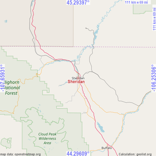
Sheridan GPS coordinates[2]
44° 47' 49.884" North, 106° 57' 22.248" West
| Map corner | latitude | longitude |
|---|---|---|
| Upper-left | 45.29397°, | -107.65931° |
| Center: | 44.79719°, | -106.95618° |
| Lower-right: | 44.29609°, | -106.25306° |
| Map W x H: | 111×111 km | = 69×69mi |
| max Lat: | 71.29058° ⇑8.4% North |
| Sheridan: | 44.79719° |
| min Lat: | ⇓91.6% South 19.06759° |
| min Long | Sheridan | max Long |
| -171.73463° | -106.95618° | -66.98998° |
| W 15.3%⇐ | ⇒84.7% E |
Elevation
Elevation of Sheridan is 1147 m = 3763 ft, and this is 852.2 m = 2796 ft above average elevation for this country.
| Max E: |
3189 m = 10463 ft | 5.7% |
| Sheridan | 1147 m 3763 ft | |
| Avg. | 294.8 m = 967 ft | |
Min E: |
-60 m = -197 ft | 94.3% |
See also: United States elevation on elevation.city.
Geographical zone
Sheridan is located in North temperate zone (between Tropic of Cancer and the Arctic Circle). Distance of this Northern Tropic circle is 2375.1 km =1475.8 mi to South.| Distance of | km | miles | from Sheridan |
|---|---|---|---|
| North Pole | 5026.1 | 3123.1 | to North |
| Arctic Circle | 2420.2 | 1503.8 | to North |
| Tropic Cancer | 2375.1 | 1475.8 | to South |
| Equator | 4981 | 3095 | to South |


Nearby cities:
15 places around Sheridan: (largest is in red/bold)
• Ashland
103.6 km =64.4 mi,  31°
31°
• Basin
97.5 km =60.6 mi,  241°
241°
• Buffalo
53.9 km =33.5 mi,  157°
157°
• Busby
82.3 km =51.1 mi,  0°
0°
• Crow Agency
97.8 km =60.8 mi,  336°
336°
• Dayton
25.6 km =15.9 mi,  289°
289°
• Greybull
93.5 km =58.1 mi,  248°
248°
• Hardin
116 km =72.1 mi,  333°
333°
• Lame Deer
94.6 km =58.8 mi,  13°
13°
• Lovell
113.1 km =70.3 mi,  272°
272°
• Muddy
93 km =57.8 mi, 9°
• Ranchester
20.5 km =12.7 mi,  307°
307°
• Story
25.3 km =15.7 mi,  167°
167°
• Washakie Ten
108.6 km =67.5 mi,  224°
224°
• Worland
117.6 km =73.1 mi, 222°
Sources, notices
• [Note1] Compared only with cities in United States existing in our database
• [Src1] Map data: © OpenStreetMap contributors (CC-BY-SA)
• [Src2] Other city data from geonames.org with taken over terms of usage.
• [Src3] Geographical zone / Annual Mean Temperature by Robert A. Rohde @ Wikipedia
