Sundance geodata
Sundance (Wyoming) is a seat of a second-order administrative division; located in United States in America/Denver (GMT-6) time zone. With population of 1,272 people, there are 14723 cities with bigger population in this country. Compared to other cities in United States, 90.1% of cities are located further ↓South; 82.8% of cities are located further →East and 96.3% of cities have lower elevation than Sundance. Note1


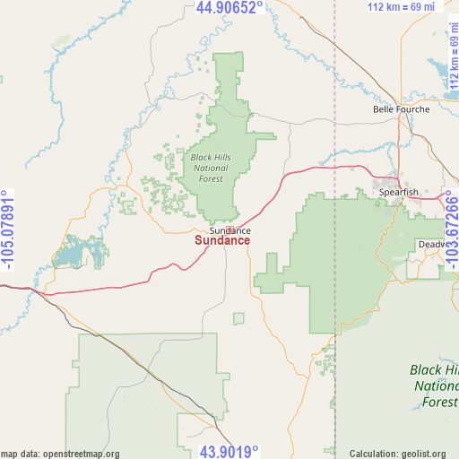
Sundance GPS coordinates[2]
44° 24' 22.932" North, 104° 22' 32.808" West
| Map corner | latitude | longitude |
|---|---|---|
| Upper-left | 44.90652°, | -105.07891° |
| Center: | 44.40637°, | -104.37578° |
| Lower-right: | 43.9019°, | -103.67266° |
| Map W x H: | 111.7×111.7 km | = 69.4×69.4mi |
| max Lat: | 71.29058° ⇑9.9% North |
| Sundance: | 44.40637° |
| min Lat: | ⇓90.1% South 19.06759° |
| min Long | Sundance | max Long |
| -171.73463° | -104.37578° | -66.98998° |
| W 17.2%⇐ | ⇒82.8% E |
Elevation
Elevation of Sundance is 1450 m = 4757 ft, and this is 1155.2 m = 3790 ft above average elevation for this country.
| Max E: |
3189 m = 10463 ft | 3.7% |
| Sundance | 1450 m 4757 ft | |
| Avg. | 294.8 m = 967 ft | |
Min E: |
-60 m = -197 ft | 96.3% |
See also: United States elevation on elevation.city.
Geographical zone
Sundance is located in North temperate zone (between Tropic of Cancer and the Arctic Circle). Distance of this Northern Tropic circle is 2331.6 km =1448.8 mi to South.| Distance of | km | miles | from Sundance |
|---|---|---|---|
| North Pole | 5069.5 | 3150 | to North |
| Arctic Circle | 2463.6 | 1530.8 | to North |
| Tropic Cancer | 2331.6 | 1448.8 | to South |
| Equator | 4937.5 | 3068 | to South |


Nearby cities:
15 places around Sundance: (largest is in red/bold)
• Belle Fourche
50.9 km =31.6 mi,  54°
54°
• Deadwood
51.4 km =31.9 mi,  93°
93°
• Hill City
82.8 km =51.4 mi,  129°
129°
• Johnson Siding
82.8 km =51.4 mi,  115°
115°
• Lead
48.9 km =30.4 mi,  97°
97°
• Moorcroft
48.4 km =30.1 mi,  250°
250°
• Newcastle
62.8 km =39 mi,  167°
167°
• Newell
83.1 km =51.6 mi,  65°
65°
• North Spearfish
40 km =24.9 mi, 73°
• Piedmont
80.9 km =50.3 mi, 103°
• Pine Haven
35 km =21.7 mi,  261°
261°
• Spearfish
42.1 km =26.2 mi,  77°
77°
• Sturgis
68.8 km =42.8 mi, 89°
• Upton
39.6 km =24.6 mi,  210°
210°
• Whitewood
58.9 km =36.6 mi, 84°
Sources, notices
• [Note1] Compared only with cities in United States existing in our database
• [Src1] Map data: © OpenStreetMap contributors (CC-BY-SA)
• [Src2] Other city data from geonames.org with taken over terms of usage.
• [Src3] Geographical zone / Annual Mean Temperature by Robert A. Rohde @ Wikipedia
