Kahului geodata
Kahului (Hawaii) is a populated place; located in United States in Pacific/Honolulu (GMT-10) time zone. With population of 26,337 people, there are 1903 cities with bigger population in this country. Compared to other cities in United States, 99.8% of cities are located further ↑North; 99.4% of cities are located further →East and 99.1% of cities have higher elevation than Kahului. Note1


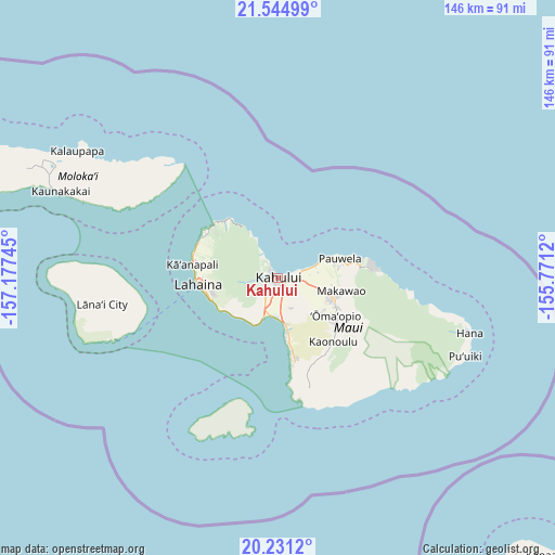
Kahului GPS coordinates[2]
20° 53' 22.308" North, 156° 28' 27.552" West
| Map corner | latitude | longitude |
|---|---|---|
| Upper-left | 21.54499°, | -157.17745° |
| Center: | 20.88953°, | -156.47432° |
| Lower-right: | 20.2312°, | -155.7712° |
| Map W x H: | 146.1×146.1 km | = 90.8×90.8mi |
| max Lat: | 71.29058° ⇑99.8% North |
| Kahului: | 20.88953° |
| min Lat: | ⇓0.2% South 19.06759° |
| min Long | Kahului | max Long |
| -171.73463° | -156.47432° | -66.98998° |
| W 0.6%⇐ | ⇒99.4% E |
Elevation
Elevation of Kahului is 3 m = 10 ft, and this is 291.8 m = 957 ft below average elevation for this country.
| Max E: |
3189 m = 10463 ft | 99.1% |
| Avg. | 294.8 m = 967 ft | |
| Kahului | 3 m = 10 ft | |
Min E: |
-60 m = -197 ft | 0.9% |
See also: United States elevation on elevation.city.
Geographical zone
Kahului is located in North Torrid zone (between Equator and Tropic of Cancer). Distance of this Northern Tropic circle is 283.2 km =176 mi to North.| Distance of | km | miles | from Kahului |
|---|---|---|---|
| North Pole | 7684.4 | 4774.9 | to North |
| Arctic Circle | 5078.5 | 3155.6 | to North |
| Tropic Cancer | 283.2 | 176 | to North |
| Equator | 2322.7 | 1443.3 | to South |


Nearby cities:
15 places around Kahului: (largest is in red/bold)
• Haiku-Pauwela
17.9 km =11.1 mi,  78°
78°
• Haliimaile
13.5 km =8.4 mi,  98°
98°
• Kaanapali Landing
22.6 km =14 mi,  281°
281°
• Kula
18.8 km =11.7 mi,  125°
125°
• Kīhei
14.2 km =8.8 mi,  167°
167°
• Lahaina
21.1 km =13.1 mi,  265°
265°
• Launiupoko
17.5 km =10.9 mi,  255°
255°
• Makawao
17.1 km =10.6 mi, 102°
• Napili-Honokowai
23.2 km =14.4 mi,  294°
294°
• Paia
11 km =6.8 mi, 81°
• Pukalani
15.5 km =9.6 mi,  112°
112°
• Waihee-Waiehu
5.5 km =3.4 mi,  325°
325°
• Waikapū
4.9 km =3 mi,  224°
224°
• Wailea
22.5 km =14 mi, 171°
• Wailuku
3.3 km =2.1 mi, 273°
Sources, notices
• [Note1] Compared only with cities in United States existing in our database
• [Src1] Map data: © OpenStreetMap contributors (CC-BY-SA)
• [Src2] Other city data from geonames.org with taken over terms of usage.
• [Src3] Geographical zone / Annual Mean Temperature by Robert A. Rohde @ Wikipedia
