Green Harbor-Cedar Crest geodata
Green Harbor-Cedar Crest (Massachusetts) is a populated place; located in United States in America/New_York (GMT-4) time zone. With population of 2,609 people, there are 10375 cities with bigger population in this country. Compared to other cities in United States, 76.3% of cities are located further ↓South; 98.2% of cities are located further ←West and 90% of cities have higher elevation than Green Harbor-Cedar Crest. Note1
Administrative division(s):
- Level 1: Massachusetts
- Level 2: Plymouth County
- Level 3: Town of Marshfield
Current local time in Green Harbor-Cedar Crest:
05:53 AM, FridayDifference from your time zone: hours


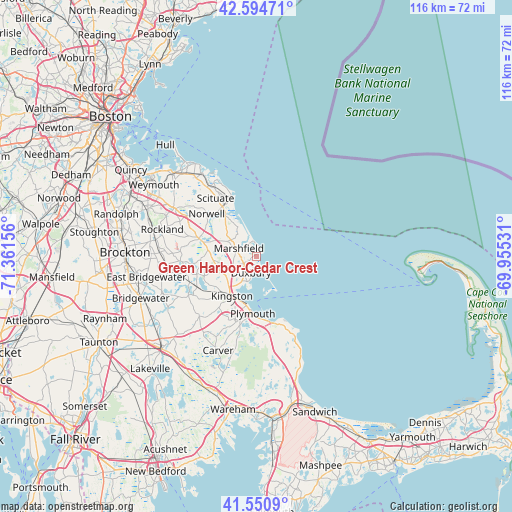
Green Harbor-Cedar Crest GPS coordinates[2]
42° 4' 29.82" North, 70° 39' 30.348" West
| Map corner | latitude | longitude |
|---|---|---|
| Upper-left | 42.59471°, | -71.36156° |
| Center: | 42.07495°, | -70.65843° |
| Lower-right: | 41.5509°, | -69.95531° |
| Map W x H: | 116.1×116.1 km | = 72.1×72.1mi |
| max Lat: | 71.29058° ⇑23.7% North |
| Green Harbor-Cedar Crest: | 42.07495° |
| min Lat: | ⇓76.3% South 19.06759° |
| min Long | Green Harbor-Ce | max Long |
| -171.73463° | -70.65843° | -66.98998° |
| W 98.2%⇐ | ⇒1.8% E |
Elevation
Elevation of Green Harbor-Cedar Crest is 16 m = 52 ft, and this is 278.8 m = 915 ft below average elevation for this country.
| Max E: |
3189 m = 10463 ft | 90% |
| Avg. | 294.8 m = 967 ft | |
| Green Harbor-Cedar Crest | 16 m = 52 ft | |
Min E: |
-60 m = -197 ft | 10% |
See also: United States elevation on elevation.city.
Geographical zone
Green Harbor-Cedar Crest is located in North temperate zone (between Tropic of Cancer and the Arctic Circle). Distance of this Northern Tropic circle is 2072.4 km =1287.7 mi to South.| Distance of | km | miles | from Green Harbor-Cedar Crest |
|---|---|---|---|
| North Pole | 5328.8 | 3311.2 | to North |
| Arctic Circle | 2722.9 | 1691.9 | to North |
| Tropic Cancer | 2072.4 | 1287.7 | to South |
| Equator | 4678.3 | 2907 | to South |


Nearby cities:
15 places around Green Harbor-Cedar Crest: (largest is in red/bold)
• Duxbury
3.9 km =2.4 mi,  197°
197°
• Hanover
13.4 km =8.3 mi,  288°
288°
• Hanson
18.3 km =11.4 mi,  270°
270°
• Kingston
10.5 km =6.5 mi,  211°
211°
• Marshfield
4.3 km =2.7 mi,  295°
295°
• Marshfield Hills
10.4 km =6.5 mi,  319°
319°
• North Pembroke
11.3 km =7 mi,  280°
280°
• North Plymouth
11.7 km =7.3 mi,  189°
189°
• North Scituate
19.1 km =11.9 mi,  326°
326°
• Norwell
14.8 km =9.2 mi,  310°
310°
• Ocean Bluff-Brant Rock
3 km =1.9 mi,  1°
1°
• Plymouth
13 km =8.1 mi,  183°
183°
• Plympton
18.7 km =11.6 mi,  223°
223°
• Scituate
14.6 km =9.1 mi,  337°
337°
• South Duxbury
6.1 km =3.8 mi, 199°
Sources, notices
• [Note1] Compared only with cities in United States existing in our database
• [Src1] Map data: © OpenStreetMap contributors (CC-BY-SA)
• [Src2] Other city data from geonames.org with taken over terms of usage.
• [Src3] Geographical zone / Annual Mean Temperature by Robert A. Rohde @ Wikipedia
