Ocean Bluff-Brant Rock geodata
Ocean Bluff-Brant Rock (Massachusetts) is a populated place; located in United States in America/New_York (GMT-4) time zone. With population of 4,970 people, there are 7206 cities with bigger population in this country. Compared to other cities in United States, 76.6% of cities are located further ↓South; 98.2% of cities are located further ←West and 99.6% of cities have higher elevation than Ocean Bluff-Brant Rock. Note1
Administrative division(s):
- Level 1: Massachusetts
- Level 2: Plymouth County
- Level 3: Town of Marshfield
Current local time in Ocean Bluff-Brant Rock:
06:11 AM, TuesdayDifference from your time zone: hours


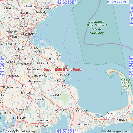
Ocean Bluff-Brant Rock GPS coordinates[2]
42° 6' 8.424" North, 70° 39' 26.496" West
| Map corner | latitude | longitude |
|---|---|---|
| Upper-left | 42.62188°, | -71.36049° |
| Center: | 42.10234°, | -70.65736° |
| Lower-right: | 41.57851°, | -69.95424° |
| Map W x H: | 116×116 km | = 72.1×72.1mi |
| max Lat: | 71.29058° ⇑23.4% North |
| Ocean Bluff-Brant Rock: | 42.10234° |
| min Lat: | ⇓76.6% South 19.06759° |
| min Long | Ocean Bluff-Bra | max Long |
| -171.73463° | -70.65736° | -66.98998° |
| W 98.2%⇐ | ⇒1.8% E |
Elevation
Elevation of Ocean Bluff-Brant Rock is 1 m = 3 ft, and this is 293.8 m = 964 ft below average elevation for this country.
| Max E: |
3189 m = 10463 ft | 99.6% |
| Avg. | 294.8 m = 967 ft | |
| Ocean Bluff-Brant Rock | 1 m = 3 ft | |
Min E: |
-60 m = -197 ft | 0.4% |
See also: United States elevation on elevation.city.
Geographical zone
Ocean Bluff-Brant Rock is located in North temperate zone (between Tropic of Cancer and the Arctic Circle). Distance of this Northern Tropic circle is 2075.4 km =1289.6 mi to South.| Distance of | km | miles | from Ocean Bluff-Brant Rock |
|---|---|---|---|
| North Pole | 5325.7 | 3309.2 | to North |
| Arctic Circle | 2719.8 | 1690 | to North |
| Tropic Cancer | 2075.4 | 1289.6 | to South |
| Equator | 4681.3 | 2908.8 | to South |


Nearby cities:
15 places around Ocean Bluff-Brant Rock: (largest is in red/bold)
• Cohasset
19.6 km =12.2 mi,  322°
322°
• Duxbury
6.8 km =4.2 mi,  190°
190°
• Green Harbor-Cedar Crest
3 km =1.9 mi,  181°
181°
• Hanover
12.8 km =8 mi,  275°
275°
• Hanson
18.6 km =11.6 mi,  260°
260°
• Kingston
13.2 km =8.2 mi,  204°
204°
• Marshfield
4.1 km =2.5 mi,  253°
253°
• Marshfield Hills
8.3 km =5.2 mi,  305°
305°
• North Pembroke
11.2 km =7 mi, 264°
• North Plymouth
14.8 km =9.2 mi, 188°
• North Scituate
16.7 km =10.4 mi, 320°
• Norwell
13.1 km =8.1 mi,  300°
300°
• Plymouth
16 km =9.9 mi, 182°
• Scituate
11.8 km =7.3 mi,  331°
331°
• South Duxbury
9.1 km =5.7 mi, 193°
Sources, notices
• [Note1] Compared only with cities in United States existing in our database
• [Src1] Map data: © OpenStreetMap contributors (CC-BY-SA)
• [Src2] Other city data from geonames.org with taken over terms of usage.
• [Src3] Geographical zone / Annual Mean Temperature by Robert A. Rohde @ Wikipedia
