Fort Meade geodata
Fort Meade (Maryland) is a populated place; located in United States in America/New_York (GMT-4) time zone. With population of 9,327 people, there are 4680 cities with bigger population in this country. Compared to other cities in United States, 53.9% of cities are located further ↑North; 81.7% of cities are located further ←West and 77.7% of cities have higher elevation than Fort Meade. Note1


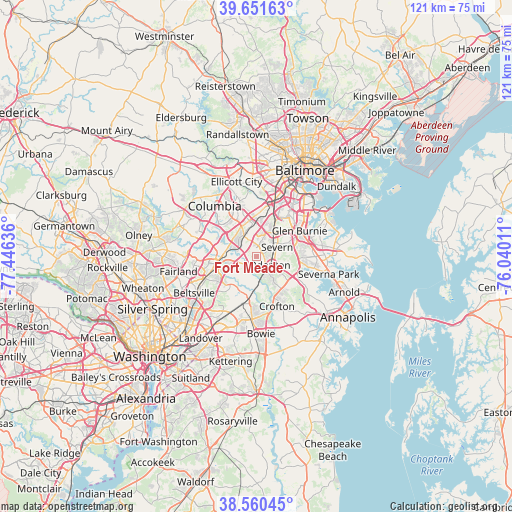
Fort Meade GPS coordinates[2]
39° 6' 29.34" North, 76° 44' 35.628" West
| Map corner | latitude | longitude |
|---|---|---|
| Upper-left | 39.65163°, | -77.44636° |
| Center: | 39.10815°, | -76.74323° |
| Lower-right: | 38.56045°, | -76.04011° |
| Map W x H: | 121.3×121.3 km | = 75.4×75.4mi |
| max Lat: | 71.29058° ⇑53.9% North |
| Fort Meade: | 39.10815° |
| min Lat: | ⇓46.1% South 19.06759° |
| min Long | Fort Meade | max Long |
| -171.73463° | -76.74323° | -66.98998° |
| W 81.7%⇐ | ⇒18.3% E |
Elevation
Elevation of Fort Meade is 57 m = 187 ft, and this is 237.8 m = 780 ft below average elevation for this country.
| Max E: |
3189 m = 10463 ft | 77.7% |
| Avg. | 294.8 m = 967 ft | |
| Fort Meade | 57 m = 187 ft | |
Min E: |
-60 m = -197 ft | 22.3% |
See also: United States elevation on elevation.city.
Geographical zone
Fort Meade is located in North temperate zone (between Tropic of Cancer and the Arctic Circle). Distance of this Northern Tropic circle is 1742.5 km =1082.7 mi to South.| Distance of | km | miles | from Fort Meade |
|---|---|---|---|
| North Pole | 5658.6 | 3516.1 | to North |
| Arctic Circle | 3052.8 | 1896.9 | to North |
| Tropic Cancer | 1742.5 | 1082.7 | to South |
| Equator | 4348.4 | 2702 | to South |


Nearby cities:
15 places around Fort Meade: (largest is in red/bold)
• Elkridge
11.9 km =7.4 mi,  12°
12°
• Fort George G Mead Junction
4.4 km =2.7 mi,  296°
296°
• Gambrills
8.1 km =5 mi,  124°
124°
• Glen Burnie
11.9 km =7.4 mi,  59°
59°
• Hanover
9.6 km =6 mi, 9°
• Jessup
5.3 km =3.3 mi,  328°
328°
• Laurel
9.1 km =5.7 mi,  263°
263°
• Maryland City
6.7 km =4.2 mi,  254°
254°
• North Laurel
11.5 km =7.1 mi,  287°
287°
• Odenton
4.6 km =2.9 mi,  125°
125°
• Savage
7.7 km =4.8 mi, 295°
• Severn
5 km =3.1 mi,  50°
50°
• South Gate
10.4 km =6.5 mi,  77°
77°
• South Laurel
10.2 km =6.3 mi, 245°
• West Elkridge
11.1 km =6.9 mi, 7°
Sources, notices
• [Note1] Compared only with cities in United States existing in our database
• [Src1] Map data: © OpenStreetMap contributors (CC-BY-SA)
• [Src2] Other city data from geonames.org with taken over terms of usage.
• [Src3] Geographical zone / Annual Mean Temperature by Robert A. Rohde @ Wikipedia
