Carmel Hamlet geodata
Carmel Hamlet (New York) is a populated place; located in United States in America/New_York (GMT-4) time zone. With population of 6,817 people, there are 5916 cities with bigger population in this country. Compared to other cities in United States, 69.9% of cities are located further ↓South; 92.2% of cities are located further ←West and 59.1% of cities have higher elevation than Carmel Hamlet. Note1


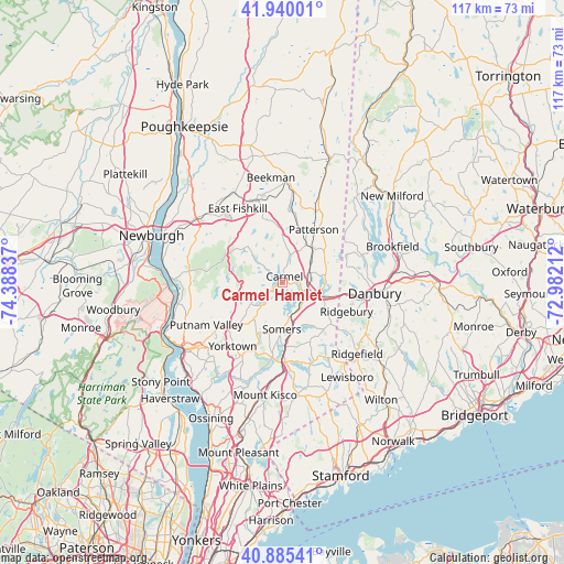
Carmel Hamlet GPS coordinates[2]
41° 24' 53.46" North, 73° 41' 6.864" West
| Map corner | latitude | longitude |
|---|---|---|
| Upper-left | 41.94001°, | -74.38837° |
| Center: | 41.41485°, | -73.68524° |
| Lower-right: | 40.88541°, | -72.98212° |
| Map W x H: | 117.3×117.3 km | = 72.9×72.9mi |
| max Lat: | 71.29058° ⇑30.1% North |
| Carmel Hamlet: | 41.41485° |
| min Lat: | ⇓69.9% South 19.06759° |
| min Long | Carmel Hamlet | max Long |
| -171.73463° | -73.68524° | -66.98998° |
| W 92.2%⇐ | ⇒7.8% E |
Elevation
Elevation of Carmel Hamlet is 159 m = 522 ft, and this is 135.8 m = 446 ft below average elevation for this country.
| Max E: |
3189 m = 10463 ft | 59.1% |
| Avg. | 294.8 m = 967 ft | |
| Carmel Hamlet | 159 m = 522 ft | |
Min E: |
-60 m = -197 ft | 40.9% |
See also: United States elevation on elevation.city.
Geographical zone
Carmel Hamlet is located in North temperate zone (between Tropic of Cancer and the Arctic Circle). Distance of this Northern Tropic circle is 1999 km =1242.1 mi to South.| Distance of | km | miles | from Carmel Hamlet |
|---|---|---|---|
| North Pole | 5402.2 | 3356.8 | to North |
| Arctic Circle | 2796.3 | 1737.5 | to North |
| Tropic Cancer | 1999 | 1242.1 | to South |
| Equator | 4604.9 | 2861.4 | to South |


Nearby cities:
15 places around Carmel Hamlet: (largest is in red/bold)
• Brewster
6 km =3.7 mi,  108°
108°
• Brewster Hill
6.8 km =4.2 mi,  81°
81°
• Carmel
1.7 km =1.1 mi,  14°
14°
• Goldens Bridge
13.5 km =8.4 mi,  177°
177°
• Heritage Hills
8.4 km =5.2 mi,  186°
186°
• Jefferson Valley-Yorktown
14.5 km =9 mi,  221°
221°
• Katonah
17.3 km =10.7 mi, 180°
• Lake Carmel
5.3 km =3.3 mi, 12°
• Lake Mohegan
17.2 km =10.7 mi,  231°
231°
• Lincolndale
10.6 km =6.6 mi,  195°
195°
• Mahopac
6.2 km =3.9 mi, 220°
• Peach Lake
10.4 km =6.5 mi,  120°
120°
• Putnam Lake
12.7 km =7.9 mi,  65°
65°
• Shenorock
10.2 km =6.3 mi,  205°
205°
• Shrub Oak
14.8 km =9.2 mi, 229°
Sources, notices
• [Note1] Compared only with cities in United States existing in our database
• [Src1] Map data: © OpenStreetMap contributors (CC-BY-SA)
• [Src2] Other city data from geonames.org with taken over terms of usage.
• [Src3] Geographical zone / Annual Mean Temperature by Robert A. Rohde @ Wikipedia
