Homeacre-Lyndora geodata
Homeacre-Lyndora (Pennsylvania) is a populated place; located in United States in America/New_York (GMT-4) time zone. With population of 6,906 people, there are 5870 cities with bigger population in this country. Compared to other cities in United States, 64.3% of cities are located further ↓South; 73.6% of cities are located further ←West and 82.6% of cities have lower elevation than Homeacre-Lyndora. Note1
Administrative division(s):
- Level 1: Pennsylvania
- Level 2: Butler County
- Level 3: Township of Butler


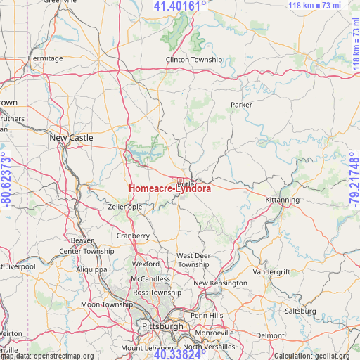
Homeacre-Lyndora GPS coordinates[2]
40° 52' 19.416" North, 79° 55' 14.16" West
| Map corner | latitude | longitude |
|---|---|---|
| Upper-left | 41.40161°, | -80.62373° |
| Center: | 40.87206°, | -79.9206° |
| Lower-right: | 40.33824°, | -79.21748° |
| Map W x H: | 118.2×118.2 km | = 73.4×73.4mi |
| max Lat: | 71.29058° ⇑35.7% North |
| Homeacre-Lyndora: | 40.87206° |
| min Lat: | ⇓64.3% South 19.06759° |
| min Long | Homeacre-Lyndor | max Long |
| -171.73463° | -79.9206° | -66.98998° |
| W 73.6%⇐ | ⇒26.4% E |
Elevation
Elevation of Homeacre-Lyndora is 384 m = 1260 ft, and this is 89.2 m = 293 ft above average elevation for this country.
| Max E: |
3189 m = 10463 ft | 17.4% |
| Homeacre-Lyndora | 384 m 1260 ft | |
| Avg. | 294.8 m = 967 ft | |
Min E: |
-60 m = -197 ft | 82.6% |
See also: United States elevation on elevation.city.
Geographical zone
Homeacre-Lyndora is located in North temperate zone (between Tropic of Cancer and the Arctic Circle). Distance of this Northern Tropic circle is 1938.6 km =1204.6 mi to South.| Distance of | km | miles | from Homeacre-Lyndora |
|---|---|---|---|
| North Pole | 5462.5 | 3394.2 | to North |
| Arctic Circle | 2856.6 | 1775 | to North |
| Tropic Cancer | 1938.6 | 1204.6 | to South |
| Equator | 4544.5 | 2823.8 | to South |


Nearby cities:
15 places around Homeacre-Lyndora: (largest is in red/bold)
• Butler
2.4 km =1.5 mi,  119°
119°
• Chicora
17.2 km =10.7 mi,  60°
60°
• Connoquenessing
9.9 km =6.2 mi,  232°
232°
• East Butler
6.3 km =3.9 mi,  84°
84°
• Evans City
16.6 km =10.3 mi, 226°
• Harmony
19.1 km =11.9 mi,  245°
245°
• Meadowood
4 km =2.5 mi,  146°
146°
• Meridian
4.4 km =2.7 mi, 232°
• Nixon
9.9 km =6.2 mi,  184°
184°
• Oak Hills
5.3 km =3.3 mi,  173°
173°
• Prospect
11.2 km =7 mi,  288°
288°
• Saxonburg
16.1 km =10 mi,  144°
144°
• Shanor-Northvue
4.3 km =2.7 mi,  5°
5°
• Unionville
8.5 km =5.3 mi,  335°
335°
• Zelienople
20.1 km =12.5 mi,  244°
244°
Sources, notices
• [Note1] Compared only with cities in United States existing in our database
• [Src1] Map data: © OpenStreetMap contributors (CC-BY-SA)
• [Src2] Other city data from geonames.org with taken over terms of usage.
• [Src3] Geographical zone / Annual Mean Temperature by Robert A. Rohde @ Wikipedia
