Shanor-Northvue geodata
Shanor-Northvue (Pennsylvania) is a populated place; located in United States in America/New_York (GMT-4) time zone. With population of 5,051 people, there are 7125 cities with bigger population in this country. Compared to other cities in United States, 64.8% of cities are located further ↓South; 73.6% of cities are located further ←West and 80.5% of cities have lower elevation than Shanor-Northvue. Note1
Administrative division(s):
- Level 1: Pennsylvania
- Level 2: Butler County
- Level 3: Township of Center


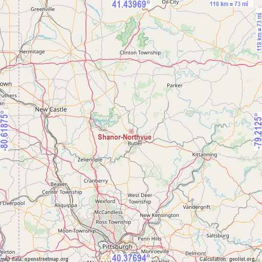
Shanor-Northvue GPS coordinates[2]
40° 54' 37.62" North, 79° 54' 56.232" West
| Map corner | latitude | longitude |
|---|---|---|
| Upper-left | 41.43969°, | -80.61875° |
| Center: | 40.91045°, | -79.91562° |
| Lower-right: | 40.37694°, | -79.2125° |
| Map W x H: | 118.2×118.2 km | = 73.4×73.4mi |
| max Lat: | 71.29058° ⇑35.2% North |
| Shanor-Northvue: | 40.91045° |
| min Lat: | ⇓64.8% South 19.06759° |
| min Long | Shanor-Northvue | max Long |
| -171.73463° | -79.91562° | -66.98998° |
| W 73.6%⇐ | ⇒26.4% E |
Elevation
Elevation of Shanor-Northvue is 358 m = 1175 ft, and this is 63.2 m = 207 ft above average elevation for this country.
| Max E: |
3189 m = 10463 ft | 19.5% |
| Shanor-Northvue | 358 m 1175 ft | |
| Avg. | 294.8 m = 967 ft | |
Min E: |
-60 m = -197 ft | 80.5% |
See also: United States elevation on elevation.city.
Geographical zone
Shanor-Northvue is located in North temperate zone (between Tropic of Cancer and the Arctic Circle). Distance of this Northern Tropic circle is 1942.9 km =1207.3 mi to South.| Distance of | km | miles | from Shanor-Northvue |
|---|---|---|---|
| North Pole | 5458.2 | 3391.6 | to North |
| Arctic Circle | 2852.4 | 1772.4 | to North |
| Tropic Cancer | 1942.9 | 1207.3 | to South |
| Equator | 4548.8 | 2826.5 | to South |


Nearby cities:
15 places around Shanor-Northvue: (largest is in red/bold)
• Butler
5.7 km =3.5 mi,  162°
162°
• Chicora
15.1 km =9.4 mi,  73°
73°
• Connoquenessing
13.2 km =8.2 mi,  218°
218°
• East Butler
6.9 km =4.3 mi,  121°
121°
• Evans City
20 km =12.4 mi, 218°
• Homeacre-Lyndora
4.3 km =2.7 mi,  185°
185°
• Lake Arthur Estates
20.8 km =12.9 mi,  285°
285°
• Meadowood
7.8 km =4.8 mi,  166°
166°
• Meridian
7.9 km =4.9 mi,  209°
209°
• Nixon
14.2 km =8.8 mi,  184°
184°
• Oak Hills
9.5 km =5.9 mi, 178°
• Prospect
11 km =6.8 mi,  266°
266°
• Saxonburg
19.5 km =12.1 mi,  152°
152°
• Slippery Rock
20.8 km =12.9 mi,  325°
325°
• Unionville
5.2 km =3.2 mi,  311°
311°
Sources, notices
• [Note1] Compared only with cities in United States existing in our database
• [Src1] Map data: © OpenStreetMap contributors (CC-BY-SA)
• [Src2] Other city data from geonames.org with taken over terms of usage.
• [Src3] Geographical zone / Annual Mean Temperature by Robert A. Rohde @ Wikipedia
