Bellair-Meadowbrook Terrace geodata
Bellair-Meadowbrook Terrace (Florida) is a populated place; located in United States in America/New_York (GMT-4) time zone. With population of 13,343 people, there are 3585 cities with bigger population in this country. Compared to other cities in United States, 92.9% of cities are located further ↑North; 66.5% of cities are located further ←West and 86.2% of cities have higher elevation than Bellair-Meadowbrook Terrace. Note1
Current local time in Bellair-Meadowbrook Terrace:
08:23 AM, FridayDifference from your time zone: hours


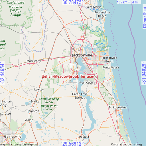
Bellair-Meadowbrook Terrace GPS coordinates[2]
30° 10' 43.716" North, 81° 44' 36.276" West
| Map corner | latitude | longitude |
|---|---|---|
| Upper-left | 30.78475°, | -82.44654° |
| Center: | 30.17881°, | -81.74341° |
| Lower-right: | 29.56912°, | -81.04029° |
| Map W x H: | 135.2×135.2 km | = 84×84mi |
| max Lat: | 71.29058° ⇑92.9% North |
| Bellair-Meadowbrook Terrace: | 30.17881° |
| min Lat: | ⇓7.1% South 19.06759° |
| min Long | Bellair-Meadowb | max Long |
| -171.73463° | -81.74341° | -66.98998° |
| W 66.5%⇐ | ⇒33.5% E |
Elevation
Elevation of Bellair-Meadowbrook Terrace is 25 m = 82 ft, and this is 269.8 m = 885 ft below average elevation for this country.
| Max E: |
3189 m = 10463 ft | 86.2% |
| Avg. | 294.8 m = 967 ft | |
| Bellair-Meadowbrook Terrace | 25 m = 82 ft | |
Min E: |
-60 m = -197 ft | 13.8% |
See also: United States elevation on elevation.city.
Geographical zone
Bellair-Meadowbrook Terrace is located in North temperate zone (between Tropic of Cancer and the Arctic Circle). Distance of this Northern Tropic circle is 749.7 km =465.8 mi to South.| Distance of | km | miles | from Bellair-Meadowbrook Terrace |
|---|---|---|---|
| North Pole | 6651.5 | 4133 | to North |
| Arctic Circle | 4045.6 | 2513.8 | to North |
| Tropic Cancer | 749.7 | 465.8 | to South |
| Equator | 3355.6 | 2085.1 | to South |


Nearby cities:
15 places around Bellair-Meadowbrook Terrace: (largest is in red/bold)
• Asbury Lake
16.3 km =10.1 mi,  207°
207°
• Baldwin
26.2 km =16.3 mi,  301°
301°
• Fleming Island
9.8 km =6.1 mi,  166°
166°
• Fruit Cove
12.3 km =7.6 mi,  127°
127°
• Green Cove Springs
21.7 km =13.5 mi,  163°
163°
• Jacksonville
19 km =11.8 mi,  26°
26°
• Lakeside
5.9 km =3.7 mi,  203°
203°
• Middleburg
16.6 km =10.3 mi,  222°
222°
• Nocatee
34.4 km =21.4 mi,  107°
107°
• Oakleaf Plantation
8.9 km =5.5 mi,  264°
264°
• Orange Park
3.8 km =2.4 mi, 111°
• Palm Valley
34.2 km =21.3 mi,  90°
90°
• Penney Farms
23.1 km =14.4 mi, 196°
• Ponte Vedra Beach
35 km =21.7 mi,  78°
78°
• St. Johns
21.7 km =13.5 mi,  119°
119°
Sources, notices
• [Note1] Compared only with cities in United States existing in our database
• [Src1] Map data: © OpenStreetMap contributors (CC-BY-SA)
• [Src2] Other city data from geonames.org with taken over terms of usage.
• [Src3] Geographical zone / Annual Mean Temperature by Robert A. Rohde @ Wikipedia
