Highlands-Baywood Park geodata
Highlands-Baywood Park (California) is a populated place; located in United States in America/Los_Angeles (GMT-7) time zone. With population of 4,027 people, there are 8185 cities with bigger population in this country. Compared to other cities in United States, 64% of cities are located further ↑North; 96.2% of cities are located further →East and 54.5% of cities have higher elevation than Highlands-Baywood Park. Note1


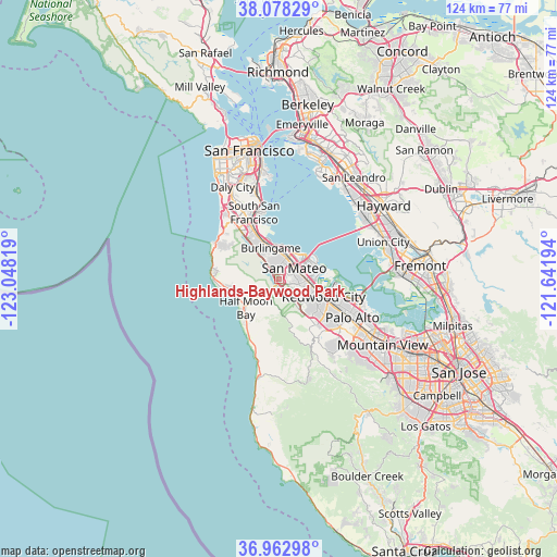
Highlands-Baywood Park GPS coordinates[2]
37° 31' 21.792" North, 122° 20' 42.216" West
| Map corner | latitude | longitude |
|---|---|---|
| Upper-left | 38.07829°, | -123.04819° |
| Center: | 37.52272°, | -122.34506° |
| Lower-right: | 36.96298°, | -121.64194° |
| Map W x H: | 124×124 km | = 77.1×77.1mi |
| max Lat: | 71.29058° ⇑64% North |
| Highlands-Baywood Park: | 37.52272° |
| min Lat: | ⇓36% South 19.06759° |
| min Long | Highlands-Baywo | max Long |
| -171.73463° | -122.34506° | -66.98998° |
| W 3.8%⇐ | ⇒96.2% E |
Elevation
Elevation of Highlands-Baywood Park is 182 m = 597 ft, and this is 112.8 m = 370 ft below average elevation for this country.
| Max E: |
3189 m = 10463 ft | 54.5% |
| Avg. | 294.8 m = 967 ft | |
| Highlands-Baywood Park | 182 m = 597 ft | |
Min E: |
-60 m = -197 ft | 45.5% |
See also: United States elevation on elevation.city.
Geographical zone
Highlands-Baywood Park is located in North temperate zone (between Tropic of Cancer and the Arctic Circle). Distance of this Northern Tropic circle is 1566.2 km =973.2 mi to South.| Distance of | km | miles | from Highlands-Baywood Park |
|---|---|---|---|
| North Pole | 5834.9 | 3625.6 | to North |
| Arctic Circle | 3229 | 2006.4 | to North |
| Tropic Cancer | 1566.2 | 973.2 | to South |
| Equator | 4172.1 | 2592.4 | to South |


Nearby cities:
15 places around Highlands-Baywood Park: (largest is in red/bold)
• Belmont
6.1 km =3.8 mi,  92°
92°
• Burlingame
7.1 km =4.4 mi,  344°
344°
• El Granada
11.2 km =7 mi,  258°
258°
• Emerald Lake Hills
9.4 km =5.8 mi,  133°
133°
• Foster City
7.6 km =4.7 mi,  58°
58°
• Half Moon Bay
9.9 km =6.2 mi,  228°
228°
• Hillsborough
6.5 km =4 mi,  332°
332°
• Millbrae
9.2 km =5.7 mi, 336°
• North Fair Oaks
14.2 km =8.8 mi,  112°
112°
• Redwood City
10.5 km =6.5 mi, 113°
• Redwood Shores
8.6 km =5.3 mi,  83°
83°
• San Bruno
13.3 km =8.3 mi, 334°
• San Carlos
7.7 km =4.8 mi,  103°
103°
• San Mateo
4.8 km =3 mi,  21°
21°
• Woodside
13.1 km =8.1 mi,  142°
142°
Sources, notices
• [Note1] Compared only with cities in United States existing in our database
• [Src1] Map data: © OpenStreetMap contributors (CC-BY-SA)
• [Src2] Other city data from geonames.org with taken over terms of usage.
• [Src3] Geographical zone / Annual Mean Temperature by Robert A. Rohde @ Wikipedia
