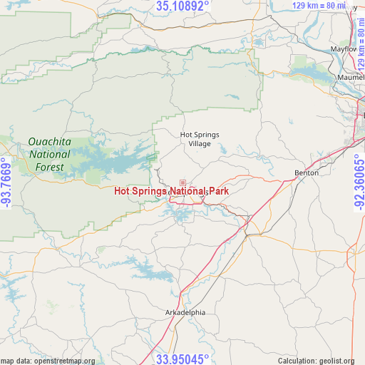
Hot Springs National Park geodata
Hot Springs National Park (Arkansas) is a populated place; located in United States in America/Chicago (GMT-5) time zone. With population of 35,193 people, there are 1400 cities with bigger population in this country. Compared to other cities in United States, 77.5% of cities are located further ↑North; 66.4% of cities are located further →East and 57.7% of cities have lower elevation than Hot Springs National Park. Note1
Administrative division(s):
- Level 1: Arkansas
- Level 2: Garland County
- Level 3: Township of Hot Springs
Current local time in Hot Springs National Park:
02:10 AM, WednesdayDifference from your time zone: hours


Hot Springs National Park GPS coordinates[2]
34° 31' 54.12" North, 93° 3' 49.572" West
| Map corner | latitude | longitude |
|---|---|---|
| Upper-left | 35.10892°, | -93.7669° |
| Center: | 34.5317°, | -93.06377° |
| Lower-right: | 33.95045°, | -92.36065° |
| Map W x H: | 128.8×128.8 km | = 80×80mi |
| max Lat: | 71.29058° ⇑77.5% North |
| Hot Springs National Park: | 34.5317° |
| min Lat: | ⇓22.5% South 19.06759° |
| min Long | Hot Springs Nat | max Long |
| -171.73463° | -93.06377° | -66.98998° |
| W 33.6%⇐ | ⇒66.4% E |
Elevation
Elevation of Hot Springs National Park is 229 m = 751 ft, and this is 65.8 m = 216 ft below average elevation for this country.
| Max E: |
3189 m = 10463 ft | 42.3% |
| Avg. | 294.8 m = 967 ft | |
| Hot Springs National Park | 229 m = 751 ft | |
Min E: |
-60 m = -197 ft | 57.7% |
See also: United States elevation on elevation.city.
Geographical zone
Hot Springs National Park is located in North temperate zone (between Tropic of Cancer and the Arctic Circle). Distance of this Northern Tropic circle is 1233.6 km =766.5 mi to South.| Distance of | km | miles | from Hot Springs National Park |
|---|---|---|---|
| North Pole | 6167.5 | 3832.3 | to North |
| Arctic Circle | 3561.6 | 2213.1 | to North |
| Tropic Cancer | 1233.6 | 766.5 | to South |
| Equator | 3839.6 | 2385.8 | to South |


Nearby cities:
15 places around Hot Springs National Park: (largest is in red/bold)
• Arkadelphia
45.7 km =28.4 mi,  178°
178°
• Avilla
46.9 km =29.1 mi,  69°
69°
• Benton
43.8 km =27.2 mi,  85°
85°
• Caddo Valley
38.9 km =24.2 mi, 180°
• Fountain Lake
8.3 km =5.2 mi,  56°
56°
• Haskell
39.3 km =24.4 mi, 94°
• Hot Springs
3.2 km =2 mi,  165°
165°
• Hot Springs Village
16.7 km =10.4 mi,  20°
20°
• Lake Hamilton
12.3 km =7.6 mi,  193°
193°
• Malvern
29.7 km =18.5 mi,  129°
129°
• Mountain Pine
11 km =6.8 mi,  294°
294°
• Piney
6.5 km =4 mi,  240°
240°
• Rockport
27.1 km =16.8 mi, 126°
• Rockwell
9.9 km =6.2 mi,  220°
220°
• Traskwood
38.7 km =24 mi,  103°
103°
Sources, notices
• [Note1] Compared only with cities in United States existing in our database
• [Src1] Map data: © OpenStreetMap contributors (CC-BY-SA)
• [Src2] Other city data from geonames.org with taken over terms of usage.
• [Src3] Geographical zone / Annual Mean Temperature by Robert A. Rohde @ Wikipedia
