Vân Đình geodata
Vân Đình (Hanoi) is a seat of a second-order administrative division; located in Vietnam in Asia/Ho_Chi_Minh (GMT+7) time zone. In our database, there are 94 cities with bigger population. Compared to other cities in Vietnam, 68.2% of cities are located further ↓South; 65.3% of cities are located further →East and 58.1% of cities have higher elevation than Vân Đình. Note1


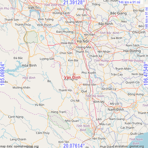
Vân Đình GPS coordinates[2]
20° 44' 6.504" North, 105° 46' 20.496" East
| Map corner | latitude | longitude |
|---|---|---|
| Upper-left | 21.39128°, | 105.06924° |
| Center: | 20.73514°, | 105.77236° |
| Lower-right: | 20.07614°, | 106.47549° |
| Map W x H: | 146.2×146.2 km | = 90.8×90.8mi |
| max Lat: | 23.27841° ⇑31.8% North |
| Vân Đình: | 20.73514° |
| min Lat: | ⇓68.2% South 8.65724° |
| min Long | Vân Đình | max Long |
| 102.4579° | 105.77236° | 112.72541° |
| W 34.7%⇐ | ⇒65.3% E |
Elevation
Elevation of Vân Đình is 11 m = 36 ft, and this is 118.5 m = 389 ft below average elevation for this country.
| Max E: |
1592 m = 5223 ft | 58.1% |
| Avg. | 129.5 m = 425 ft | |
| Vân Đình | 11 m = 36 ft | |
Min E: |
-1 m = -3 ft | 41.9% |
See also: Vietnam elevation on elevation.city.
Geographical zone
Vân Đình is located in North Torrid zone (between Equator and Tropic of Cancer). Distance of this Northern Tropic circle is 300.4 km =186.7 mi to North.| Distance of | km | miles | from Vân Đình |
|---|---|---|---|
| North Pole | 7701.5 | 4785.5 | to North |
| Arctic Circle | 5095.6 | 3166.3 | to North |
| Tropic Cancer | 300.4 | 186.7 | to North |
| Equator | 2305.5 | 1432.6 | to South |


Nearby cities:
15 places around Vân Đình: (largest is in red/bold)
• Bo
25.5 km =15.8 mi,  254°
254°
• Chi Nê
27.2 km =16.9 mi,  178°
178°
• Chúc Sơn
22.2 km =13.8 mi,  340°
340°
• Hà Đông
26.3 km =16.3 mi,  1°
1°
• Hòa Mạc
24.8 km =15.4 mi,  114°
114°
• Khoái Châu
24.3 km =15.1 mi,  61°
61°
• Kim Bài
13.1 km =8.1 mi,  358°
358°
• Phú Xuyên
14.7 km =9.1 mi,  85°
85°
• Phủ Lý
25.6 km =15.9 mi,  145°
145°
• Quế
20.1 km =12.5 mi, 148°
• Thanh Xuân
29 km =18 mi,  5°
5°
• Thường Tín
17.5 km =10.9 mi,  31°
31°
• Văn Giang
28.4 km =17.6 mi,  35°
35°
• Văn Điển
24.7 km =15.3 mi,  17°
17°
• Đại Nghĩa
6.1 km =3.8 mi,  208°
208°
Sources, notices
• [Note1] Compared only with cities in Vietnam existing in our database
• [Src1] Map data: © OpenStreetMap contributors (CC-BY-SA)
• [Src2] Other city data from geonames.org with taken over terms of usage.
• [Src3] Geographical zone / Annual Mean Temperature by Robert A. Rohde @ Wikipedia
