Doug An geodata
Doug An (Quảng Nam) is a seat of a second-order administrative division; located in Vietnam in Asia/Ho_Chi_Minh (GMT+7) time zone. In our database, there are 94 cities with bigger population. Compared to other cities in Vietnam, 54.3% of cities are located further ↑North; 86% of cities are located further ←West and 66.4% of cities have lower elevation than Doug An. Note1


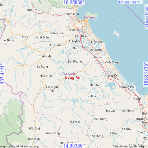
Doug An GPS coordinates[2]
15° 34' 56.064" North, 108° 6' 51.192" East
| Map corner | latitude | longitude |
|---|---|---|
| Upper-left | 16.25839°, | 107.4111° |
| Center: | 15.58224°, | 108.11422° |
| Lower-right: | 14.90386°, | 108.81735° |
| Map W x H: | 150.6×150.6 km | = 93.6×93.6mi |
| max Lat: | 23.27841° ⇑54.3% North |
| Doug An: | 15.58224° |
| min Lat: | ⇓45.7% South 8.65724° |
| min Long | Doug An | max Long |
| 102.4579° | 108.11422° | 112.72541° |
| W 86%⇐ | ⇒14% E |
Elevation
Elevation of Doug An is 40 m = 131 ft, and this is 89.5 m = 294 ft below average elevation for this country.
| Max E: |
1592 m = 5223 ft | 33.6% |
| Avg. | 129.5 m = 425 ft | |
| Doug An | 40 m = 131 ft | |
Min E: |
-1 m = -3 ft | 66.4% |
See also: Vietnam elevation on elevation.city.
Geographical zone
Doug An is located in North Torrid zone (between Equator and Tropic of Cancer). Distance of this Northern Tropic circle is 873.3 km =542.6 mi to North.| Distance of | km | miles | from Doug An |
|---|---|---|---|
| North Pole | 8274.5 | 5141.5 | to North |
| Arctic Circle | 5668.6 | 3522.3 | to North |
| Tropic Cancer | 873.3 | 542.6 | to North |
| Equator | 1732.6 | 1076.6 | to South |


Nearby cities:
15 places around Doug An: (largest is in red/bold)
• Cẩm Lệ
49.4 km =30.7 mi,  11°
11°
• Duy Xuyên
31.5 km =19.6 mi,  29°
29°
• Hà Lam
30.7 km =19.1 mi,  55°
55°
• Hòa Vang
45.2 km =28.1 mi,  3°
3°
• Hội An
40.6 km =25.2 mi,  35°
35°
• Khâm Đức
37.6 km =23.4 mi,  246°
246°
• Ngũ Hành Sơn
50.5 km =31.4 mi,  17°
17°
• Phú Ninh
32 km =19.9 mi,  95°
95°
• Quang Nam
37.2 km =23.1 mi, 23°
• Quế Sơn
15.2 km =9.4 mi,  48°
48°
• Tam Kỳ
38.5 km =23.9 mi,  91°
91°
• Thạnh Mỹ
35 km =21.7 mi,  301°
301°
• Tiên Phước
23.2 km =14.4 mi,  116°
116°
• Trà My
29.3 km =18.2 mi,  157°
157°
• Đại Lộc
33.4 km =20.8 mi, 1°
Sources, notices
• [Note1] Compared only with cities in Vietnam existing in our database
• [Src1] Map data: © OpenStreetMap contributors (CC-BY-SA)
• [Src2] Other city data from geonames.org with taken over terms of usage.
• [Src3] Geographical zone / Annual Mean Temperature by Robert A. Rohde @ Wikipedia
