Trà My geodata
Trà My (Quảng Nam) is a seat of a second-order administrative division; located in Vietnam in Asia/Ho_Chi_Minh (GMT+7) time zone. In our database, there are 94 cities with bigger population. Compared to other cities in Vietnam, 55.5% of cities are located further ↑North; 87.6% of cities are located further ←West and 75.5% of cities have lower elevation than Trà My. Note1


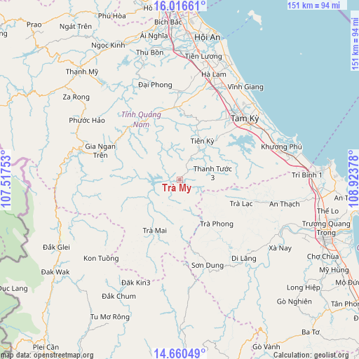
Trà My GPS coordinates[2]
15° 20' 22.74" North, 108° 13' 14.34" East
| Map corner | latitude | longitude |
|---|---|---|
| Upper-left | 16.01661°, | 107.51753° |
| Center: | 15.33965°, | 108.22065° |
| Lower-right: | 14.66049°, | 108.92378° |
| Map W x H: | 150.8×150.8 km | = 93.7×93.7mi |
| max Lat: | 23.27841° ⇑55.5% North |
| Trà My: | 15.33965° |
| min Lat: | ⇓44.5% South 8.65724° |
| min Long | Trà My | max Long |
| 102.4579° | 108.22065° | 112.72541° |
| W 87.6%⇐ | ⇒12.4% E |
Elevation
Elevation of Trà My is 110 m = 361 ft, and this is 19.5 m = 64 ft below average elevation for this country.
| Max E: |
1592 m = 5223 ft | 24.5% |
| Avg. | 129.5 m = 425 ft | |
| Trà My | 110 m = 361 ft | |
Min E: |
-1 m = -3 ft | 75.5% |
See also: Vietnam elevation on elevation.city.
Geographical zone
Trà My is located in North Torrid zone (between Equator and Tropic of Cancer). Distance of this Northern Tropic circle is 900.3 km =559.4 mi to North.| Distance of | km | miles | from Trà My |
|---|---|---|---|
| North Pole | 8301.5 | 5158.3 | to North |
| Arctic Circle | 5695.6 | 3539.1 | to North |
| Tropic Cancer | 900.3 | 559.4 | to North |
| Equator | 1705.6 | 1059.8 | to South |


Nearby cities:
15 places around Trà My: (largest is in red/bold)
• Bình Sơn
58.2 km =36.2 mi,  94°
94°
• Doug An
29.3 km =18.2 mi,  337°
337°
• Duy Xuyên
54.6 km =33.9 mi,  4°
4°
• Hà Lam
46.5 km =28.9 mi,  17°
17°
• Khâm Đức
47.3 km =29.4 mi,  284°
284°
• Núi Thành
48.1 km =29.9 mi,  77°
77°
• Phú Ninh
31.5 km =19.6 mi,  40°
40°
• Quang Nam
61.1 km =38 mi, 3°
• Quế Sơn
37.1 km =23.1 mi,  359°
359°
• Sơn Hà
42.5 km =26.4 mi,  141°
141°
• Tam Kỳ
37.6 km =23.4 mi,  46°
46°
• Tiên Phước
19 km =11.8 mi,  29°
29°
• Trà Bồng
33.1 km =20.6 mi,  106°
106°
• Tây Trà
24.1 km =15 mi, 141°
• Đắk Glei
59.2 km =36.8 mi,  241°
241°
Sources, notices
• [Note1] Compared only with cities in Vietnam existing in our database
• [Src1] Map data: © OpenStreetMap contributors (CC-BY-SA)
• [Src2] Other city data from geonames.org with taken over terms of usage.
• [Src3] Geographical zone / Annual Mean Temperature by Robert A. Rohde @ Wikipedia
