Ḩajjah geodata
Ḩajjah is a seat of a first-order administrative division; located in Yemen in Asia/Aden (GMT+3) time zone. With population of 43,549 people, there are 12 cities with bigger population in this country. Compared to other cities in Yemen, 72.1% of cities are located further ↓South; 79.9% of cities are located further →East and 65.9% of cities have lower elevation than Ḩajjah. Note1


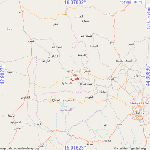
Ḩajjah GPS coordinates[2]
15° 41' 39.3" North, 43° 36' 20.952" East
| Map corner | latitude | longitude |
|---|---|---|
| Upper-left | 16.37002°, | 42.9027° |
| Center: | 15.69425°, | 43.60582° |
| Lower-right: | 15.01623°, | 44.30895° |
| Map W x H: | 150.5×150.5 km | = 93.5×93.5mi |
| max Lat: | 17.76999° ⇑27.9% North |
| Ḩajjah: | 15.69425° |
| min Lat: | ⇓72.1% South 12.18576° |
| min Long | Ḩajjah | max Long |
| 42.67107° | 43.60582° | 54.01895° |
| W 20.1%⇐ | ⇒79.9% E |
Elevation
Elevation of Ḩajjah is 1795 m = 5889 ft, and this is 490.2 m = 1608 ft above average elevation for this country.
| Max E: |
2791 m = 9157 ft | 34.1% |
| Ḩajjah | 1795 m 5889 ft | |
| Avg. | 1304.8 m = 4281 ft | |
Min E: |
4 m = 13 ft | 65.9% |
See also: Ḩajjah elevation on elevation.city.
Geographical zone
Ḩajjah is located in North Torrid zone (between Equator and Tropic of Cancer). Distance of this Northern Tropic circle is 860.9 km =534.9 mi to North.| Distance of | km | miles | from Ḩajjah |
|---|---|---|---|
| North Pole | 8262 | 5133.8 | to North |
| Arctic Circle | 5656.1 | 3514.5 | to North |
| Tropic Cancer | 860.9 | 534.9 | to North |
| Equator | 1745 | 1084.3 | to South |


Nearby cities:
15 places around Ḩajjah: (largest is in red/bold)
• Al Maghrabah
21.4 km =13.3 mi,  17°
17°
• Al Maḩwīt
25.8 km =16 mi,  194°
194°
• An Nāşirah
23.4 km =14.5 mi,  68°
68°
• Ar Rujum
26.4 km =16.4 mi,  173°
173°
• Ash Shaghādirah
12.3 km =7.6 mi,  227°
227°
• Ash Shāhil
28.8 km =17.9 mi,  311°
311°
• Aş Şarārah
30.4 km =18.9 mi, 68°
• Aţ Ţawīlah
27 km =16.8 mi,  145°
145°
• Banī al ‘Awwām
12.7 km =7.9 mi, 188°
• Banī an Nahārī
8 km =5 mi,  221°
221°
• Bayt ‘Adhāqah
13.5 km =8.4 mi,  130°
130°
• Kuḩlān ‘Affār
12.9 km =8 mi, 70°
• Mabyan
7.1 km =4.4 mi, 312°
• Sharas
5.1 km =3.2 mi, 66°
• Waḑarah
13.3 km =8.3 mi,  277°
277°
Sources, notices
• [Note1] Compared only with cities in Yemen existing in our database
• [Src1] Map data: © OpenStreetMap contributors (CC-BY-SA)
• [Src2] Other city data from geonames.org with taken over terms of usage.
• [Src3] Geographical zone / Annual Mean Temperature by Robert A. Rohde @ Wikipedia
