Banī al ‘Awwām geodata
Banī al ‘Awwām (Ḩajjah) is a seat of a second-order administrative division; located in Yemen in Asia/Aden (GMT+3) time zone. With population of 41 people, there are 46 cities with bigger population in this country. Compared to other cities in Yemen, 68.5% of cities are located further ↓South; 81.2% of cities are located further →East and 57.5% of cities have lower elevation than Banī al ‘Awwām. Note1


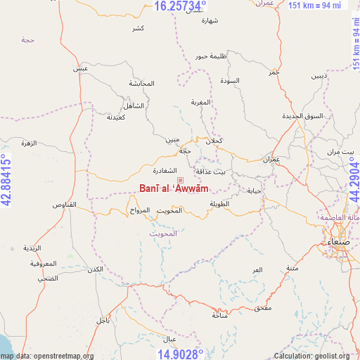
Banī al ‘Awwām GPS coordinates[2]
15° 34' 52.284" North, 43° 35' 14.172" East
| Map corner | latitude | longitude |
|---|---|---|
| Upper-left | 16.25734°, | 42.88415° |
| Center: | 15.58119°, | 43.58727° |
| Lower-right: | 14.9028°, | 44.2904° |
| Map W x H: | 150.6×150.6 km | = 93.6×93.6mi |
| max Lat: | 17.76999° ⇑31.5% North |
| Banī al ‘Awwām: | 15.58119° |
| min Lat: | ⇓68.5% South 12.18576° |
| min Long | Banī al ‘Aww | max Long |
| 42.67107° | 43.58727° | 54.01895° |
| W 18.8%⇐ | ⇒81.2% E |
Elevation
Elevation of Banī al ‘Awwām is 1528 m = 5013 ft, and this is 223.2 m = 732 ft above average elevation for this country.
| Max E: |
2791 m = 9157 ft | 42.5% |
| Banī al ‘Awwām | 1528 m 5013 ft | |
| Avg. | 1304.8 m = 4281 ft | |
Min E: |
4 m = 13 ft | 57.5% |
See also: Yemen elevation on elevation.city.
Geographical zone
Banī al ‘Awwām is located in North Torrid zone (between Equator and Tropic of Cancer). Distance of this Northern Tropic circle is 873.5 km =542.8 mi to North.| Distance of | km | miles | from Banī al ‘Awwām |
|---|---|---|---|
| North Pole | 8274.6 | 5141.6 | to North |
| Arctic Circle | 5668.7 | 3522.4 | to North |
| Tropic Cancer | 873.5 | 542.8 | to North |
| Equator | 1732.5 | 1076.5 | to South |


Nearby cities:
15 places around Banī al ‘Awwām: (largest is in red/bold)
• Al Maḩwīt
13.2 km =8.2 mi,  200°
200°
• Al Mirwāḩ
20.8 km =12.9 mi,  234°
234°
• An Nāşirah
31.9 km =19.8 mi,  48°
48°
• Ar Rujum
14.5 km =9 mi,  160°
160°
• Ash Shaghādirah
8.3 km =5.2 mi,  301°
301°
• Aş Şafaqayn
28.7 km =17.8 mi,  218°
218°
• Aţ Ţawīlah
19.7 km =12.2 mi,  119°
119°
• Banī an Nahārī
7.3 km =4.5 mi,  333°
333°
• Bayt ‘Adhāqah
12.9 km =8 mi,  72°
72°
• Kuḩlān ‘Affār
22 km =13.7 mi,  39°
39°
• Mabyan
17.7 km =11 mi,  349°
349°
• Sharas
16 km =9.9 mi,  24°
24°
• Waḑarah
18.2 km =11.3 mi,  322°
322°
• Ḩabābah
31.2 km =19.4 mi,  97°
97°
• Ḩajjah
12.7 km =7.9 mi,  8°
8°
Sources, notices
• [Note1] Compared only with cities in Yemen existing in our database
• [Src1] Map data: © OpenStreetMap contributors (CC-BY-SA)
• [Src2] Other city data from geonames.org with taken over terms of usage.
• [Src3] Geographical zone / Annual Mean Temperature by Robert A. Rohde @ Wikipedia
