Ouangani geodata
Ouangani is a seat of a first-order administrative division; located in Mayotte in Indian/Mayotte (GMT+3) time zone. With population of 7,272 people, there are 9 cities with bigger population in this country. Compared to other cities in Mayotte, 68.7% of cities are located further ↑North; 56.3% of cities are located further ←West and 93.8% of cities have lower elevation than Ouangani. Note1


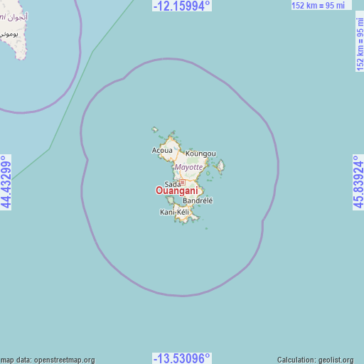
Ouangani GPS coordinates[2]
12° 50' 47.004" South, 45° 8' 9.996" East
| Map corner | latitude | longitude |
|---|---|---|
| Upper-left | -12.15994°, | 44.43299° |
| Center: | -12.84639°, | 45.13611° |
| Lower-right: | -13.53096°, | 45.83924° |
| Map W x H: | 152.4×152.4 km | = 94.7×94.7mi |
| max Lat: | -12.69982° ⇑68.7% North |
| Ouangani: | -12.84639° |
| min Lat: | ⇓31.3% South -12.95361° |
| min Long | Ouangani | max Long |
| 45.05819° | 45.13611° | 45.27938° |
| W 56.3%⇐ | ⇒43.7% E |
Elevation
Elevation of Ouangani is 100 m = 328 ft, and this is 56.1 m = 184 ft above average elevation for this country.
| Max E: |
109 m = 358 ft | 6.2% |
| Ouangani | 100 m 328 ft | |
| Avg. | 43.9 m = 144 ft | |
Min E: |
10 m = 33 ft | 93.8% |
See also: Mayotte elevation on elevation.city.
Geographical zone
Ouangani is located in South Torrid zone (between Equator and Tropic of Capricorn). Distance of this Southern Tropic circle is 1177.5 km =731.7 mi to South.| Distance of | km | miles | from Ouangani |
|---|---|---|---|
| Equator | 1428.4 | 887.6 | to North |
| Tropic Capricorn | 1177.5 | 731.7 | to South |
| Antarctic Circle | 5972.8 | 3711.3 | to South |
| South Pole | 8578.7 | 5330.6 | to South |


Nearby cities:
15 places around Ouangani: (largest is in red/bold)
• Acoua
16 km =9.9 mi,  328°
328°
• Bandraboua
15.9 km =9.9 mi,  354°
354°
• Bandrélé
9.6 km =6 mi,  140°
140°
• Bouéni
9 km =5.6 mi,  226°
226°
• Chiconi
3.1 km =1.9 mi,  297°
297°
• Chirongui
9.6 km =6 mi,  172°
172°
• Dembeni
5.2 km =3.2 mi,  86°
86°
• Dzaoudzi
14.9 km =9.3 mi,  61°
61°
• Kani Kéli
12.4 km =7.7 mi,  196°
196°
• Koungou
14.6 km =9.1 mi,  30°
30°
• M'Tsangamouji
11.2 km =7 mi, 329°
• Mamoudzou
12.3 km =7.6 mi,  54°
54°
• Pamandzi
16.5 km =10.3 mi,  70°
70°
• Sada
3.7 km =2.3 mi,  262°
262°
• Tsingoni
7.5 km =4.7 mi, 331°
Sources, notices
• [Note1] Compared only with cities in Mayotte existing in our database
• [Src1] Map data: © OpenStreetMap contributors (CC-BY-SA)
• [Src2] Other city data from geonames.org with taken over terms of usage.
• [Src3] Geographical zone / Annual Mean Temperature by Robert A. Rohde @ Wikipedia
