Saldanha geodata
Saldanha (Western Cape) is a populated place; located in South Africa in Africa/Johannesburg (GMT+2) time zone. With population of 68,284 people, there are 76 cities with bigger population in this country. Compared to other cities in South Africa, 84.7% of cities are located further ↑North; 99.4% of cities are located further →East and 97.3% of cities have higher elevation than Saldanha. Note1
Administrative division(s):
- Level 1: Western Cape
- Level 2: West Coast District Municipality
- Level 3: Saldanha Bay


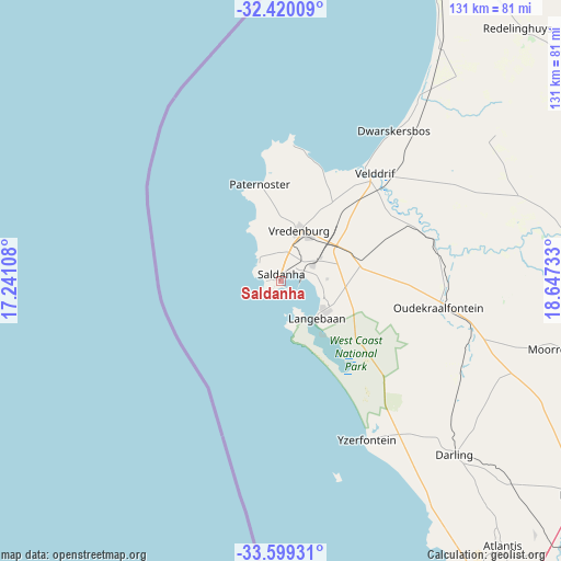
Saldanha GPS coordinates[2]
33° 0' 42.012" South, 17° 56' 39.12" East
| Map corner | latitude | longitude |
|---|---|---|
| Upper-left | -32.42009°, | 17.24108° |
| Center: | -33.01167°, | 17.9442° |
| Lower-right: | -33.59931°, | 18.64733° |
| Map W x H: | 131.1×131.1 km | = 81.5×81.5mi |
| max Lat: | -22.34881° ⇑84.7% North |
| Saldanha: | -33.01167° |
| min Lat: | ⇓15.3% South -34.66739° |
| min Long | Saldanha | max Long |
| 16.8697° | 17.9442° | 32.26762° |
| W 0.6%⇐ | ⇒99.4% E |
Elevation
Elevation of Saldanha is 20 m = 66 ft, and this is 949.6 m = 3115 ft below average elevation for this country.
| Max E: |
1873 m = 6145 ft | 97.3% |
| Avg. | 969.6 m = 3181 ft | |
| Saldanha | 20 m = 66 ft | |
Min E: |
7 m = 23 ft | 2.7% |
See also: Saldanha elevation on elevation.city.
Geographical zone
Saldanha is located in South temperate zone (between Tropic of Capricorn and the Antarctic Circle). Distance of this Southern Tropic circle is 1064.6 km =661.5 mi to North.| Distance of | km | miles | from Saldanha |
|---|---|---|---|
| Equator | 3670.6 | 2280.8 | to North |
| Tropic Capricorn | 1064.6 | 661.5 | to North |
| Antarctic Circle | 3730.6 | 2318.1 | to South |
| South Pole | 6336.5 | 3937.3 | to South |


Nearby cities:
15 places around Saldanha: (largest is in red/bold)
• Atlantis
79.5 km =49.4 mi,  140°
140°
• Cape Town
110.9 km =68.9 mi,  156°
156°
• Claremont
118.1 km =73.4 mi, 155°
• Constantia
121.6 km =75.6 mi, 158°
• Kraaifontein
117.4 km =72.9 mi, 142°
• Lansdowne
120 km =74.6 mi,  154°
154°
• Malmesbury
88.3 km =54.9 mi,  124°
124°
• Moorreesburg
68.6 km =42.6 mi,  103°
103°
• Newlands
117.2 km =72.8 mi, 156°
• Piketberg
76.8 km =47.7 mi,  80°
80°
• Rondebosch
116.8 km =72.6 mi, 154°
• Rosebank
115.9 km =72 mi, 154°
• Sunset Beach
106.6 km =66.2 mi, 151°
• Vredenburg
12.4 km =7.7 mi,  20°
20°
• Wellington
121.3 km =75.4 mi,  125°
125°
Sources, notices
• [Note1] Compared only with cities in South Africa existing in our database
• [Src1] Map data: © OpenStreetMap contributors (CC-BY-SA)
• [Src2] Other city data from geonames.org with taken over terms of usage.
• [Src3] Geographical zone / Annual Mean Temperature by Robert A. Rohde @ Wikipedia
