Bulqizë geodata
Bulqizë (Dibër) is a seat of a second-order administrative division; located in Albania in Europe/Tirane (GMT+2) time zone. With population of 11,212 people, there are 29 cities with bigger population in this country. Compared to other cities in Albania, 70.7% of cities are located further ↓South; 70.1% of cities are located further ←West and 82.5% of cities have lower elevation than Bulqizë. Note1


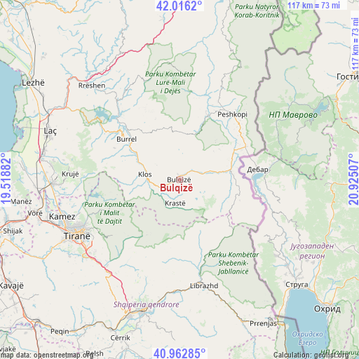
Bulqizë GPS coordinates[2]
41° 29' 30.012" North, 20° 13' 18.984" East
| Map corner | latitude | longitude |
|---|---|---|
| Upper-left | 42.0162°, | 19.51882° |
| Center: | 41.49167°, | 20.22194° |
| Lower-right: | 40.96285°, | 20.92507° |
| Map W x H: | 117.1×117.1 km | = 72.8×72.8mi |
| max Lat: | 42.45139° ⇑29.3% North |
| Bulqizë: | 41.49167° |
| min Lat: | ⇓70.7% South 39.65889° |
| min Long | Bulqizë | max Long |
| 19.40556° | 20.22194° | 20.99° |
| W 70.1%⇐ | ⇒29.9% E |
Elevation
Elevation of Bulqizë is 775 m = 2543 ft, and this is 400.4 m = 1314 ft above average elevation for this country.
| Max E: |
1352 m = 4436 ft | 17.5% |
| Bulqizë | 775 m 2543 ft | |
| Avg. | 374.6 m = 1229 ft | |
Min E: |
-2 m = -7 ft | 82.5% |
See also: Albania elevation on elevation.city.
Geographical zone
Bulqizë is located in North temperate zone (between Tropic of Cancer and the Arctic Circle). Distance of this Northern Tropic circle is 2007.5 km =1247.4 mi to South.| Distance of | km | miles | from Bulqizë |
|---|---|---|---|
| North Pole | 5393.6 | 3351.4 | to North |
| Arctic Circle | 2787.7 | 1732.2 | to North |
| Tropic Cancer | 2007.5 | 1247.4 | to South |
| Equator | 4613.4 | 2866.6 | to South |


Nearby cities:
15 places around Bulqizë: (largest is in red/bold)
• Burrel
22.1 km =13.7 mi,  306°
306°
• Fushë-Bulqizë
6 km =3.7 mi,  56°
56°
• Fushë-Muhurr
22.8 km =14.2 mi,  23°
23°
• Gjorica e Sipërme
19.6 km =12.2 mi,  75°
75°
• Gurra e Vogël
19.9 km =12.4 mi,  284°
284°
• Klos
11.4 km =7.1 mi, 278°
• Kombësi
22.1 km =13.7 mi,  296°
296°
• Lis
18.9 km =11.7 mi,  323°
323°
• Martanesh
10.4 km =6.5 mi,  190°
190°
• Ostreni i Math
20.6 km =12.8 mi,  109°
109°
• Selishtë
15.8 km =9.8 mi, 17°
• Shupenzë
17.3 km =10.7 mi, 75°
• Suç
17.1 km =10.6 mi, 303°
• Xibër-Murrizë
16.9 km =10.5 mi,  255°
255°
• Zerqan
11.6 km =7.2 mi, 84°
Sources, notices
• [Note1] Compared only with cities in Albania existing in our database
• [Src1] Map data: © OpenStreetMap contributors (CC-BY-SA)
• [Src2] Other city data from geonames.org with taken over terms of usage.
• [Src3] Geographical zone / Annual Mean Temperature by Robert A. Rohde @ Wikipedia
