Gurra e Vogël geodata
Gurra e Vogël (Dibër) is a seat of a third-order administrative division; located in Albania in Europe/Tirane (GMT+2) time zone. In our database, there are 71 cities with bigger population. Compared to other cities in Albania, 73% of cities are located further ↓South; 50.1% of cities are located further →East and 67.3% of cities have lower elevation than Gurra e Vogël. Note1


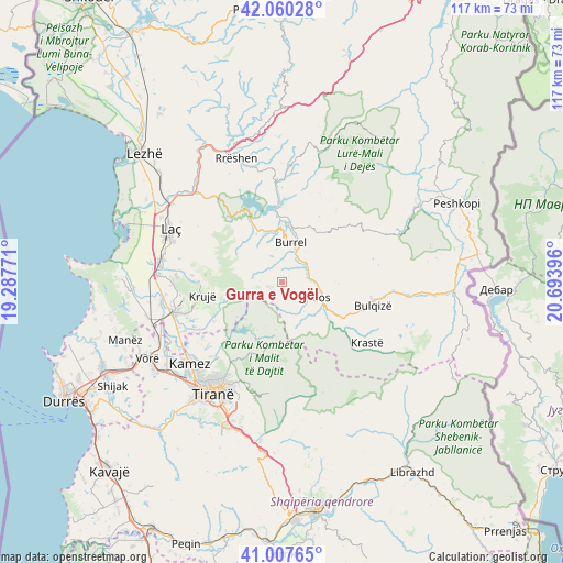
Gurra e Vogël GPS coordinates[2]
41° 32' 9.996" North, 19° 59' 26.988" East
| Map corner | latitude | longitude |
|---|---|---|
| Upper-left | 42.06028°, | 19.28771° |
| Center: | 41.53611°, | 19.99083° |
| Lower-right: | 41.00765°, | 20.69396° |
| Map W x H: | 117×117 km | = 72.7×72.7mi |
| max Lat: | 42.45139° ⇑27% North |
| Gurra e Vogël: | 41.53611° |
| min Lat: | ⇓73% South 39.65889° |
| min Long | Gurra e Vogël | max Long |
| 19.40556° | 19.99083° | 20.99° |
| W 49.9%⇐ | ⇒50.1% E |
Elevation
Elevation of Gurra e Vogël is 512 m = 1680 ft, and this is 137.4 m = 451 ft above average elevation for this country.
| Max E: |
1352 m = 4436 ft | 32.7% |
| Gurra e Vogël | 512 m 1680 ft | |
| Avg. | 374.6 m = 1229 ft | |
Min E: |
-2 m = -7 ft | 67.3% |
See also: Albania elevation on elevation.city.
Geographical zone
Gurra e Vogël is located in North temperate zone (between Tropic of Cancer and the Arctic Circle). Distance of this Northern Tropic circle is 2012.5 km =1250.5 mi to South.| Distance of | km | miles | from Gurra e Vogël |
|---|---|---|---|
| North Pole | 5388.7 | 3348.4 | to North |
| Arctic Circle | 2782.8 | 1729.2 | to North |
| Tropic Cancer | 2012.5 | 1250.5 | to South |
| Equator | 4618.4 | 2869.7 | to South |


Nearby cities:
15 places around Gurra e Vogël: (largest is in red/bold)
• Baz
11.8 km =7.3 mi,  334°
334°
• Burrel
8.4 km =5.2 mi,  10°
10°
• Cudhi Zall
12.4 km =7.7 mi,  256°
256°
• Dajt
17 km =10.6 mi,  201°
201°
• Derjan
16.3 km =10.1 mi,  20°
20°
• Kallmet
19.3 km =12 mi,  227°
227°
• Klos
8.6 km =5.3 mi,  112°
112°
• Kombësi
5.1 km =3.2 mi,  355°
355°
• Krujë
16.8 km =10.4 mi, 259°
• Lis
12.8 km =8 mi,  37°
37°
• Rukaj
16.6 km =10.3 mi, 8°
• Suç
6.8 km =4.2 mi,  47°
47°
• Ulëz
18.2 km =11.3 mi, 333°
• Xibër-Murrizë
9.5 km =5.9 mi,  162°
162°
• Zall-Bastar
12.9 km =8 mi, 203°
Sources, notices
• [Note1] Compared only with cities in Albania existing in our database
• [Src1] Map data: © OpenStreetMap contributors (CC-BY-SA)
• [Src2] Other city data from geonames.org with taken over terms of usage.
• [Src3] Geographical zone / Annual Mean Temperature by Robert A. Rohde @ Wikipedia
