San Cosme geodata
San Cosme (Corrientes) is a seat of a second-order administrative division; located in Argentina in America/Argentina/Cordoba (GMT-3) time zone. With population of 4,429 people, there are 471 cities with bigger population in this country. Compared to other cities in Argentina, 82.4% of cities are located further ↓South; 83.4% of cities are located further ←West and 73.7% of cities have higher elevation than San Cosme. Note1


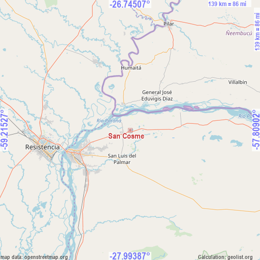
San Cosme GPS coordinates[2]
27° 22' 16.428" South, 58° 30' 43.704" West
| Map corner | latitude | longitude |
|---|---|---|
| Upper-left | -26.74507°, | -59.21527° |
| Center: | -27.37123°, | -58.51214° |
| Lower-right: | -27.99387°, | -57.80902° |
| Map W x H: | 138.9×138.9 km | = 86.3×86.3mi |
| max Lat: | -21.94467° ⇑17.6% North |
| San Cosme: | -27.37123° |
| min Lat: | ⇓82.4% South -54.81084° |
| min Long | San Cosme | max Long |
| -72.88605° | -58.51214° | -53.64581° |
| W 83.4%⇐ | ⇒16.6% E |
Elevation
Elevation of San Cosme is 72 m = 236 ft, and this is 277.3 m = 910 ft below average elevation for this country.
| Max E: |
4040 m = 13255 ft | 73.7% |
| Avg. | 349.3 m = 1146 ft | |
| San Cosme | 72 m = 236 ft | |
Min E: |
-2 m = -7 ft | 26.3% |
See also: Argentina elevation on elevation.city.
Geographical zone
San Cosme is located in South temperate zone (between Tropic of Capricorn and the Antarctic Circle). Distance of this Southern Tropic circle is 437.5 km =271.8 mi to North.| Distance of | km | miles | from San Cosme |
|---|---|---|---|
| Equator | 3043.4 | 1891.1 | to North |
| Tropic Capricorn | 437.5 | 271.8 | to North |
| Antarctic Circle | 4357.8 | 2707.8 | to South |
| South Pole | 6963.7 | 4327 | to South |


Nearby cities:
15 places around San Cosme: (largest is in red/bold)
• Barranqueras
43.9 km =27.3 mi,  253°
253°
• Colonia Benítez
43.1 km =26.8 mi,  275°
275°
• Corrientes
33.6 km =20.9 mi, 251°
• Fontana
50.8 km =31.6 mi,  264°
264°
• Herlitzka
33.3 km =20.7 mi,  130°
130°
• Itatí
28.7 km =17.8 mi,  67°
67°
• La Leonesa
41.6 km =25.8 mi,  332°
332°
• Margarita Belén
47.1 km =29.3 mi,  285°
285°
• Paso de la Patria
8.5 km =5.3 mi,  315°
315°
• Puerto Bermejo
49.4 km =30.7 mi,  0°
0°
• Puerto Vilelas
45 km =28 mi, 249°
• Ramada Paso
20.9 km =13 mi,  87°
87°
• Resistencia
47.6 km =29.6 mi, 257°
• Riachuelo
32.8 km =20.4 mi,  224°
224°
• San Luis del Palmar
15.8 km =9.8 mi,  195°
195°
Sources, notices
• [Note1] Compared only with cities in Argentina existing in our database
• [Src1] Map data: © OpenStreetMap contributors (CC-BY-SA)
• [Src2] Other city data from geonames.org with taken over terms of usage.
• [Src3] Geographical zone / Annual Mean Temperature by Robert A. Rohde @ Wikipedia
