Itatí geodata
Itatí (Corrientes) is a seat of a second-order administrative division; located in Argentina in America/Argentina/Cordoba (GMT-3) time zone. With population of 7,902 people, there are 342 cities with bigger population in this country. Compared to other cities in Argentina, 83.7% of cities are located further ↓South; 87.3% of cities are located further ←West and 77.4% of cities have higher elevation than Itatí. Note1


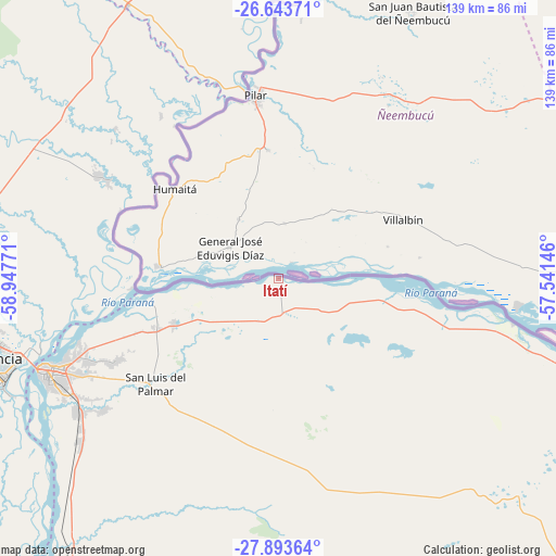
Itatí GPS coordinates[2]
27° 16' 13.548" South, 58° 14' 40.488" West
| Map corner | latitude | longitude |
|---|---|---|
| Upper-left | -26.64371°, | -58.94771° |
| Center: | -27.27043°, | -58.24458° |
| Lower-right: | -27.89364°, | -57.54146° |
| Map W x H: | 139×139 km | = 86.4×86.4mi |
| max Lat: | -21.94467° ⇑16.3% North |
| Itatí: | -27.27043° |
| min Lat: | ⇓83.7% South -54.81084° |
| min Long | Itatí | max Long |
| -72.88605° | -58.24458° | -53.64581° |
| W 87.3%⇐ | ⇒12.7% E |
Elevation
Elevation of Itatí is 65 m = 213 ft, and this is 284.3 m = 933 ft below average elevation for this country.
| Max E: |
4040 m = 13255 ft | 77.4% |
| Avg. | 349.3 m = 1146 ft | |
| Itatí | 65 m = 213 ft | |
Min E: |
-2 m = -7 ft | 22.6% |
See also: Argentina elevation on elevation.city.
Geographical zone
Itatí is located in South temperate zone (between Tropic of Capricorn and the Antarctic Circle). Distance of this Southern Tropic circle is 426.3 km =264.9 mi to North.| Distance of | km | miles | from Itatí |
|---|---|---|---|
| Equator | 3032.2 | 1884.1 | to North |
| Tropic Capricorn | 426.3 | 264.9 | to North |
| Antarctic Circle | 4369 | 2714.8 | to South |
| South Pole | 6974.9 | 4334 | to South |


Nearby cities:
15 places around Itatí: (largest is in red/bold)
• Barranqueras
72.5 km =45 mi,  251°
251°
• Colonia Benítez
69.7 km =43.3 mi,  264°
264°
• Corrientes
62.2 km =38.6 mi, 249°
• General Vedia
55.6 km =34.5 mi,  312°
312°
• Herlitzka
32.8 km =20.4 mi,  181°
181°
• La Leonesa
52.2 km =32.4 mi,  299°
299°
• Lomas de Vallejos
60.8 km =37.8 mi,  148°
148°
• Margarita Belén
71.9 km =44.7 mi,  270°
270°
• Paso de la Patria
32.8 km =20.4 mi, 260°
• Puerto Bermejo
46.3 km =28.8 mi,  325°
325°
• Puerto Vilelas
73.7 km =45.8 mi, 248°
• Ramada Paso
11.7 km =7.3 mi,  208°
208°
• Riachuelo
60.3 km =37.5 mi,  234°
234°
• San Cosme
28.7 km =17.8 mi, 247°
• San Luis del Palmar
40.4 km =25.1 mi, 229°
Sources, notices
• [Note1] Compared only with cities in Argentina existing in our database
• [Src1] Map data: © OpenStreetMap contributors (CC-BY-SA)
• [Src2] Other city data from geonames.org with taken over terms of usage.
• [Src3] Geographical zone / Annual Mean Temperature by Robert A. Rohde @ Wikipedia
