General Vedia geodata
General Vedia (Chaco) is a populated place; located in Argentina in America/Argentina/Cordoba (GMT-3) time zone. With population of 3,513 people, there are 522 cities with bigger population in this country. Compared to other cities in Argentina, 86.8% of cities are located further ↓South; 81.2% of cities are located further ←West and 80% of cities have higher elevation than General Vedia. Note1


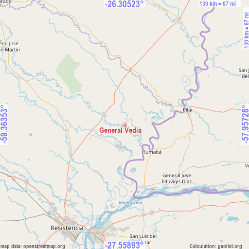
General Vedia GPS coordinates[2]
26° 56' 1.752" South, 58° 39' 37.44" West
| Map corner | latitude | longitude |
|---|---|---|
| Upper-left | -26.30523°, | -59.36353° |
| Center: | -26.93382°, | -58.6604° |
| Lower-right: | -27.55893°, | -57.95728° |
| Map W x H: | 139.4×139.4 km | = 86.6×86.6mi |
| max Lat: | -21.94467° ⇑13.2% North |
| General Vedia: | -26.93382° |
| min Lat: | ⇓86.8% South -54.81084° |
| min Long | General Vedia | max Long |
| -72.88605° | -58.6604° | -53.64581° |
| W 81.2%⇐ | ⇒18.8% E |
Elevation
Elevation of General Vedia is 58 m = 190 ft, and this is 291.3 m = 956 ft below average elevation for this country.
| Max E: |
4040 m = 13255 ft | 80% |
| Avg. | 349.3 m = 1146 ft | |
| General Vedia | 58 m = 190 ft | |
Min E: |
-2 m = -7 ft | 20% |
See also: Argentina elevation on elevation.city.
Geographical zone
General Vedia is located in South temperate zone (between Tropic of Capricorn and the Antarctic Circle). Distance of this Southern Tropic circle is 388.8 km =241.6 mi to North.| Distance of | km | miles | from General Vedia |
|---|---|---|---|
| Equator | 2994.8 | 1860.9 | to North |
| Tropic Capricorn | 388.8 | 241.6 | to North |
| Antarctic Circle | 4406.4 | 2738 | to South |
| South Pole | 7012.3 | 4357.2 | to South |


Nearby cities:
15 places around General Vedia: (largest is in red/bold)
• Colonia Benítez
52.4 km =32.6 mi,  212°
212°
• Corrientes
61.8 km =38.4 mi,  196°
196°
• Herradura
60.5 km =37.6 mi,  34°
34°
• Itatí
55.6 km =34.5 mi,  132°
132°
• La Eduvigis
41.3 km =25.7 mi,  285°
285°
• La Leonesa
12.3 km =7.6 mi, 200°
• Margarita Belén
47.8 km =29.7 mi,  220°
220°
• Pampa Almirón
52.8 km =32.8 mi,  299°
299°
• Paso de la Patria
43.5 km =27 mi,  168°
168°
• Puerto Bermejo
15 km =9.3 mi,  87°
87°
• Puerto Tirol
64.2 km =39.9 mi, 220°
• Ramada Paso
59.6 km =37 mi,  143°
143°
• San Cosme
50.8 km =31.6 mi,  163°
163°
• San Luis del Palmar
64.7 km =40.2 mi, 170°
• Villa Escolar
34.7 km =21.6 mi,  358°
358°
Sources, notices
• [Note1] Compared only with cities in Argentina existing in our database
• [Src1] Map data: © OpenStreetMap contributors (CC-BY-SA)
• [Src2] Other city data from geonames.org with taken over terms of usage.
• [Src3] Geographical zone / Annual Mean Temperature by Robert A. Rohde @ Wikipedia
