General Las Heras geodata
General Las Heras (Buenos Aires) is a seat of a second-order administrative division; located in Argentina in America/Argentina/Buenos_Aires (GMT-3) time zone. In our database, there are 785 cities with bigger population. Compared to other cities in Argentina, 77.2% of cities are located further ↑North; 77.1% of cities are located further ←West and 87.5% of cities have higher elevation than General Las Heras. Note1


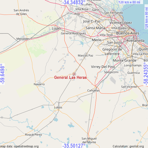
General Las Heras GPS coordinates[2]
34° 55' 36.552" South, 58° 56' 48.012" West
| Map corner | latitude | longitude |
|---|---|---|
| Upper-left | -34.34832°, | -59.6498° |
| Center: | -34.92682°, | -58.94667° |
| Lower-right: | -35.50127°, | -58.24355° |
| Map W x H: | 128.2×128.2 km | = 79.7×79.7mi |
| max Lat: | -21.94467° ⇑77.2% North |
| General Las Heras: | -34.92682° |
| min Lat: | ⇓22.8% South -54.81084° |
| min Long | General Las Her | max Long |
| -72.88605° | -58.94667° | -53.64581° |
| W 77.1%⇐ | ⇒22.9% E |
Elevation
Elevation of General Las Heras is 33 m = 108 ft, and this is 316.3 m = 1038 ft below average elevation for this country.
| Max E: |
4040 m = 13255 ft | 87.5% |
| Avg. | 349.3 m = 1146 ft | |
| General Las Heras | 33 m = 108 ft | |
Min E: |
-2 m = -7 ft | 12.5% |
See also: Argentina elevation on elevation.city.
Geographical zone
General Las Heras is located in South temperate zone (between Tropic of Capricorn and the Antarctic Circle). Distance of this Southern Tropic circle is 1277.6 km =793.9 mi to North.| Distance of | km | miles | from General Las Heras |
|---|---|---|---|
| Equator | 3883.5 | 2413.1 | to North |
| Tropic Capricorn | 1277.6 | 793.9 | to North |
| Antarctic Circle | 3517.7 | 2185.8 | to South |
| South Pole | 6123.6 | 3805 | to South |


Nearby cities:
15 places around General Las Heras: (largest is in red/bold)
• Cañuelas
22 km =13.7 mi,  130°
130°
• General Rodríguez
35.4 km =22 mi,  359°
359°
• Hurlingham
47.3 km =29.4 mi,  37°
37°
• Ituzaingó
39.5 km =24.5 mi, 40°
• José María Ezeiza
39.1 km =24.3 mi,  77°
77°
• Lobos
31.9 km =19.8 mi,  205°
205°
• Luján
42.2 km =26.2 mi,  339°
339°
• Marcos Paz
18.9 km =11.7 mi,  31°
31°
• Merlo
35.1 km =21.8 mi, 34°
• Morón
42.8 km =26.6 mi, 44°
• Muñiz
46.6 km =29 mi, 27°
• Navarro
31.5 km =19.6 mi,  253°
253°
• Pontevedra
30 km =18.6 mi,  48°
48°
• San Justo
44.9 km =27.9 mi, 51°
• San Miguel
47.7 km =29.6 mi, 26°
Sources, notices
• [Note1] Compared only with cities in Argentina existing in our database
• [Src1] Map data: © OpenStreetMap contributors (CC-BY-SA)
• [Src2] Other city data from geonames.org with taken over terms of usage.
• [Src3] Geographical zone / Annual Mean Temperature by Robert A. Rohde @ Wikipedia
