Zapala geodata
Zapala (Neuquen) is a seat of a second-order administrative division; located in Argentina in America/Argentina/Salta (GMT-3) time zone. With population of 31,534 people, there are 132 cities with bigger population in this country. Compared to other cities in Argentina, 90.9% of cities are located further ↑North; 96.3% of cities are located further →East and 92.4% of cities have lower elevation than Zapala. Note1


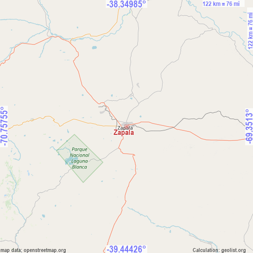
Zapala GPS coordinates[2]
38° 53' 56.976" South, 70° 3' 15.912" West
| Map corner | latitude | longitude |
|---|---|---|
| Upper-left | -38.34985°, | -70.75755° |
| Center: | -38.89916°, | -70.05442° |
| Lower-right: | -39.44426°, | -69.3513° |
| Map W x H: | 121.7×121.7 km | = 75.6×75.6mi |
| max Lat: | -21.94467° ⇑90.9% North |
| Zapala: | -38.89916° |
| min Lat: | ⇓9.1% South -54.81084° |
| min Long | Zapala | max Long |
| -72.88605° | -70.05442° | -53.64581° |
| W 3.7%⇐ | ⇒96.3% E |
Elevation
Elevation of Zapala is 1015 m = 3330 ft, and this is 665.7 m = 2184 ft above average elevation for this country.
| Max E: |
4040 m = 13255 ft | 7.6% |
| Zapala | 1015 m 3330 ft | |
| Avg. | 349.3 m = 1146 ft | |
Min E: |
-2 m = -7 ft | 92.4% |
See also: Argentina elevation on elevation.city.
Geographical zone
Zapala is located in South temperate zone (between Tropic of Capricorn and the Antarctic Circle). Distance of this Southern Tropic circle is 1719.3 km =1068.3 mi to North.| Distance of | km | miles | from Zapala |
|---|---|---|---|
| Equator | 4325.2 | 2687.6 | to North |
| Tropic Capricorn | 1719.3 | 1068.3 | to North |
| Antarctic Circle | 3076 | 1911.3 | to South |
| South Pole | 5681.9 | 3530.6 | to South |


Nearby cities:
15 places around Zapala: (largest is in red/bold)
• Aluminé
83.6 km =51.9 mi,  243°
243°
• Añelo
125.5 km =78 mi,  61°
61°
• Cutral-Có
71.4 km =44.4 mi,  93°
93°
• El Huecú
146.8 km =91.2 mi,  341°
341°
• Junín de los Andes
145.8 km =90.6 mi,  216°
216°
• Las Coloradas
86.5 km =53.7 mi,  212°
212°
• Las Lajas
49.8 km =30.9 mi,  326°
326°
• Loncopué
104.1 km =64.7 mi, 331°
• Mariano Moreno
16.8 km =10.4 mi,  9°
9°
• Picún Leufú
95.2 km =59.2 mi,  136°
136°
• Piedra del Águila
127.8 km =79.4 mi,  180°
180°
• Plaza Huincul
73.2 km =45.5 mi, 92°
• Plottier
157.7 km =98 mi, 92°
• Senillosa
140.8 km =87.5 mi,  95°
95°
• Vista Alegre
162.9 km =101.2 mi,  84°
84°
Sources, notices
• [Note1] Compared only with cities in Argentina existing in our database
• [Src1] Map data: © OpenStreetMap contributors (CC-BY-SA)
• [Src2] Other city data from geonames.org with taken over terms of usage.
• [Src3] Geographical zone / Annual Mean Temperature by Robert A. Rohde @ Wikipedia
