Villa Allende geodata
Villa Allende (Cordoba) is a populated place; located in Argentina in America/Argentina/Cordoba (GMT-3) time zone. With population of 21,683 people, there are 178 cities with bigger population in this country. Compared to other cities in Argentina, 57% of cities are located further ↓South; 64.9% of cities are located further →East and 77.4% of cities have lower elevation than Villa Allende. Note1


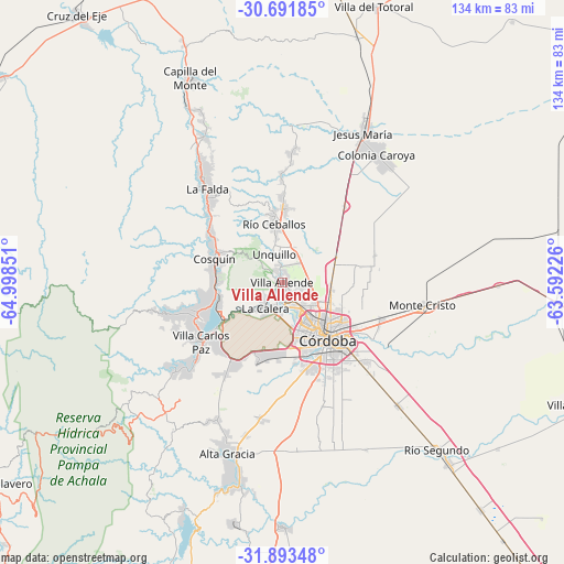
Villa Allende GPS coordinates[2]
31° 17' 40.488" South, 64° 17' 43.368" West
| Map corner | latitude | longitude |
|---|---|---|
| Upper-left | -30.69185°, | -64.99851° |
| Center: | -31.29458°, | -64.29538° |
| Lower-right: | -31.89348°, | -63.59226° |
| Map W x H: | 133.6×133.6 km | = 83×83mi |
| max Lat: | -21.94467° ⇑43% North |
| Villa Allende: | -31.29458° |
| min Lat: | ⇓57% South -54.81084° |
| min Long | Villa Allende | max Long |
| -72.88605° | -64.29538° | -53.64581° |
| W 35.1%⇐ | ⇒64.9% E |
Elevation
Elevation of Villa Allende is 505 m = 1657 ft, and this is 155.7 m = 511 ft above average elevation for this country.
| Max E: |
4040 m = 13255 ft | 22.6% |
| Villa Allende | 505 m 1657 ft | |
| Avg. | 349.3 m = 1146 ft | |
Min E: |
-2 m = -7 ft | 77.4% |
See also: Argentina elevation on elevation.city.
Geographical zone
Villa Allende is located in South temperate zone (between Tropic of Capricorn and the Antarctic Circle). Distance of this Southern Tropic circle is 873.7 km =542.9 mi to North.| Distance of | km | miles | from Villa Allende |
|---|---|---|---|
| Equator | 3479.6 | 2162.1 | to North |
| Tropic Capricorn | 873.7 | 542.9 | to North |
| Antarctic Circle | 3921.5 | 2436.7 | to South |
| South Pole | 6527.4 | 4055.9 | to South |


Nearby cities:
15 places around Villa Allende: (largest is in red/bold)
• Agua de Oro
25.4 km =15.8 mi,  358°
358°
• Cosquín
17.1 km =10.6 mi,  288°
288°
• Córdoba
17.1 km =10.6 mi,  140°
140°
• Huerta Grande
30.7 km =19.1 mi,  322°
322°
• La Calera
6.7 km =4.2 mi,  214°
214°
• La Falda
29.5 km =18.3 mi, 321°
• Malagueño
19.8 km =12.3 mi,  197°
197°
• Malvinas Argentinas
24.8 km =15.4 mi,  113°
113°
• Mendiolaza
3.1 km =1.9 mi,  350°
350°
• Río Ceballos
14.7 km =9.1 mi, 349°
• Saldán
1.4 km =0.9 mi,  231°
231°
• Salsipuedes
17.5 km =10.9 mi, 359°
• Unquillo
7.4 km =4.6 mi,  344°
344°
• Valle Hermoso
26.4 km =16.4 mi, 318°
• Villa Carlos Paz
24 km =14.9 mi, 233°
Sources, notices
• [Note1] Compared only with cities in Argentina existing in our database
• [Src1] Map data: © OpenStreetMap contributors (CC-BY-SA)
• [Src2] Other city data from geonames.org with taken over terms of usage.
• [Src3] Geographical zone / Annual Mean Temperature by Robert A. Rohde @ Wikipedia
