Saldán geodata
Saldán (Cordoba) is a populated place; located in Argentina in America/Argentina/Cordoba (GMT-3) time zone. With population of 2,099 people, there are 636 cities with bigger population in this country. Compared to other cities in Argentina, 56.8% of cities are located further ↓South; 65.4% of cities are located further →East and 76.9% of cities have lower elevation than Saldán. Note1


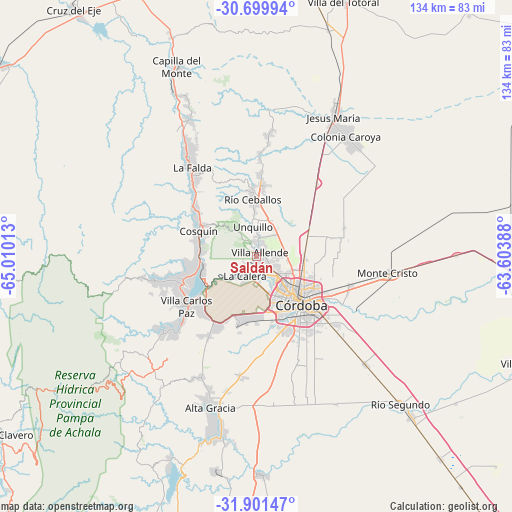
Saldán GPS coordinates[2]
31° 18' 9.432" South, 64° 18' 25.2" West
| Map corner | latitude | longitude |
|---|---|---|
| Upper-left | -30.69994°, | -65.01013° |
| Center: | -31.30262°, | -64.307° |
| Lower-right: | -31.90147°, | -63.60388° |
| Map W x H: | 133.6×133.6 km | = 83×83mi |
| max Lat: | -21.94467° ⇑43.2% North |
| Saldán: | -31.30262° |
| min Lat: | ⇓56.8% South -54.81084° |
| min Long | Saldán | max Long |
| -72.88605° | -64.307° | -53.64581° |
| W 34.6%⇐ | ⇒65.4% E |
Elevation
Elevation of Saldán is 495 m = 1624 ft, and this is 145.7 m = 478 ft above average elevation for this country.
| Max E: |
4040 m = 13255 ft | 23.1% |
| Saldán | 495 m 1624 ft | |
| Avg. | 349.3 m = 1146 ft | |
Min E: |
-2 m = -7 ft | 76.9% |
See also: Argentina elevation on elevation.city.
Geographical zone
Saldán is located in South temperate zone (between Tropic of Capricorn and the Antarctic Circle). Distance of this Southern Tropic circle is 874.6 km =543.5 mi to North.| Distance of | km | miles | from Saldán |
|---|---|---|---|
| Equator | 3480.5 | 2162.7 | to North |
| Tropic Capricorn | 874.6 | 543.5 | to North |
| Antarctic Circle | 3920.6 | 2436.1 | to South |
| South Pole | 6526.5 | 4055.4 | to South |


Nearby cities:
15 places around Saldán: (largest is in red/bold)
• Agua de Oro
26.2 km =16.3 mi,  1°
1°
• Cosquín
16.4 km =10.2 mi,  292°
292°
• Córdoba
17.2 km =10.7 mi,  135°
135°
• Huerta Grande
30.7 km =19.1 mi,  325°
325°
• La Calera
5.3 km =3.3 mi,  210°
210°
• La Falda
29.5 km =18.3 mi,  323°
323°
• Malagueño
18.7 km =11.6 mi,  195°
195°
• Malvinas Argentinas
25.5 km =15.8 mi,  110°
110°
• Mendiolaza
4 km =2.5 mi,  8°
8°
• Río Ceballos
15.4 km =9.6 mi,  354°
354°
• Salsipuedes
18.4 km =11.4 mi, 3°
• Unquillo
8 km =5 mi, 353°
• Valle Hermoso
26.4 km =16.4 mi, 321°
• Villa Allende
1.4 km =0.9 mi,  51°
51°
• Villa Carlos Paz
22.6 km =14 mi,  233°
233°
Sources, notices
• [Note1] Compared only with cities in Argentina existing in our database
• [Src1] Map data: © OpenStreetMap contributors (CC-BY-SA)
• [Src2] Other city data from geonames.org with taken over terms of usage.
• [Src3] Geographical zone / Annual Mean Temperature by Robert A. Rohde @ Wikipedia
