Salsipuedes geodata
Salsipuedes (Cordoba) is a populated place; located in Argentina in America/Argentina/Cordoba (GMT-3) time zone. With population of 6,411 people, there are 388 cities with bigger population in this country. Compared to other cities in Argentina, 58.5% of cities are located further ↓South; 65% of cities are located further →East and 86.7% of cities have lower elevation than Salsipuedes. Note1


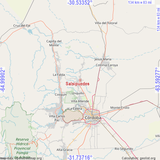
Salsipuedes GPS coordinates[2]
31° 8' 14.1" South, 64° 17' 45.204" West
| Map corner | latitude | longitude |
|---|---|---|
| Upper-left | -30.53352°, | -64.99902° |
| Center: | -31.13725°, | -64.29589° |
| Lower-right: | -31.73716°, | -63.59277° |
| Map W x H: | 133.8×133.8 km | = 83.1×83.1mi |
| max Lat: | -21.94467° ⇑41.5% North |
| Salsipuedes: | -31.13725° |
| min Lat: | ⇓58.5% South -54.81084° |
| min Long | Salsipuedes | max Long |
| -72.88605° | -64.29589° | -53.64581° |
| W 35%⇐ | ⇒65% E |
Elevation
Elevation of Salsipuedes is 739 m = 2425 ft, and this is 389.7 m = 1279 ft above average elevation for this country.
| Max E: |
4040 m = 13255 ft | 13.3% |
| Salsipuedes | 739 m 2425 ft | |
| Avg. | 349.3 m = 1146 ft | |
Min E: |
-2 m = -7 ft | 86.7% |
See also: Argentina elevation on elevation.city.
Geographical zone
Salsipuedes is located in South temperate zone (between Tropic of Capricorn and the Antarctic Circle). Distance of this Southern Tropic circle is 856.2 km =532 mi to North.| Distance of | km | miles | from Salsipuedes |
|---|---|---|---|
| Equator | 3462.1 | 2151.2 | to North |
| Tropic Capricorn | 856.2 | 532 | to North |
| Antarctic Circle | 3939 | 2447.6 | to South |
| South Pole | 6544.9 | 4066.8 | to South |


Nearby cities:
15 places around Salsipuedes: (largest is in red/bold)
• Agua de Oro
7.9 km =4.9 mi,  357°
357°
• Cosquín
20.1 km =12.5 mi,  233°
233°
• Huerta Grande
19.8 km =12.3 mi,  290°
290°
• Jesús María
25.9 km =16.1 mi,  47°
47°
• La Calera
23.3 km =14.5 mi,  189°
189°
• La Cumbre
25.4 km =15.8 mi,  312°
312°
• La Falda
19.2 km =11.9 mi, 286°
• La Granja
14.5 km =9 mi,  10°
10°
• Mendiolaza
14.5 km =9 mi,  181°
181°
• Río Ceballos
4 km =2.5 mi,  219°
219°
• Saldán
18.4 km =11.4 mi, 183°
• Unquillo
10.6 km =6.6 mi, 190°
• Valle Hermoso
17.7 km =11 mi,  277°
277°
• Villa Allende
17.5 km =10.9 mi, 179°
• Villa Giardino
21.3 km =13.2 mi,  302°
302°
Sources, notices
• [Note1] Compared only with cities in Argentina existing in our database
• [Src1] Map data: © OpenStreetMap contributors (CC-BY-SA)
• [Src2] Other city data from geonames.org with taken over terms of usage.
• [Src3] Geographical zone / Annual Mean Temperature by Robert A. Rohde @ Wikipedia
