Vera geodata
Vera (Santa Fe) is a seat of a second-order administrative division; located in Argentina in America/Argentina/Cordoba (GMT-3) time zone. With population of 19,797 people, there are 188 cities with bigger population in this country. Compared to other cities in Argentina, 66.3% of cities are located further ↓South; 66.4% of cities are located further ←West and 78.2% of cities have higher elevation than Vera. Note1


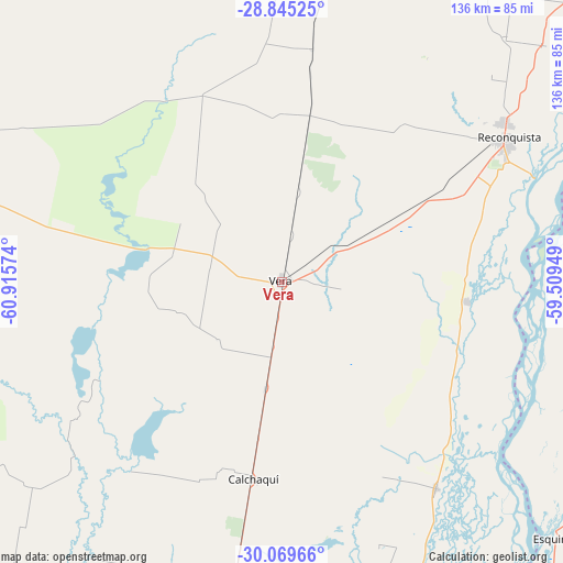
Vera GPS coordinates[2]
29° 27' 33.48" South, 60° 12' 45.396" West
| Map corner | latitude | longitude |
|---|---|---|
| Upper-left | -28.84525°, | -60.91574° |
| Center: | -29.4593°, | -60.21261° |
| Lower-right: | -30.06966°, | -59.50949° |
| Map W x H: | 136.1×136.1 km | = 84.6×84.6mi |
| max Lat: | -21.94467° ⇑33.7% North |
| Vera: | -29.4593° |
| min Lat: | ⇓66.3% South -54.81084° |
| min Long | Vera | max Long |
| -72.88605° | -60.21261° | -53.64581° |
| W 66.4%⇐ | ⇒33.6% E |
Elevation
Elevation of Vera is 64 m = 210 ft, and this is 285.3 m = 936 ft below average elevation for this country.
| Max E: |
4040 m = 13255 ft | 78.2% |
| Avg. | 349.3 m = 1146 ft | |
| Vera | 64 m = 210 ft | |
Min E: |
-2 m = -7 ft | 21.8% |
See also: Argentina elevation on elevation.city.
Geographical zone
Vera is located in South temperate zone (between Tropic of Capricorn and the Antarctic Circle). Distance of this Southern Tropic circle is 669.6 km =416.1 mi to North.| Distance of | km | miles | from Vera |
|---|---|---|---|
| Equator | 3275.6 | 2035.4 | to North |
| Tropic Capricorn | 669.6 | 416.1 | to North |
| Antarctic Circle | 4125.6 | 2563.5 | to South |
| South Pole | 6731.5 | 4182.8 | to South |


Nearby cities:
15 places around Vera: (largest is in red/bold)
• Avellaneda
65.8 km =40.9 mi,  54°
54°
• Calchaquí
48.2 km =30 mi,  188°
188°
• Colonia La Brava
109.8 km =68.2 mi,  176°
176°
• Cruz de los Milagros
136.2 km =84.6 mi,  59°
59°
• Esquina
90.4 km =56.2 mi,  133°
133°
• Goya
98.6 km =61.3 mi,  68°
68°
• Los Laureles
47.2 km =29.3 mi,  77°
77°
• Malabrigo
26.7 km =16.6 mi, 61°
• Pueblo Libertador
116.1 km =72.1 mi,  136°
136°
• Reconquista
64.5 km =40.1 mi, 57°
• San Cristóbal
136.8 km =85 mi,  226°
226°
• San Javier
127.3 km =79.1 mi,  167°
167°
• Santa Lucía
119.8 km =74.4 mi, 64°
• Villa Ocampo
136.5 km =84.8 mi,  37°
37°
• Yataity Calle
135.7 km =84.3 mi, 68°
Sources, notices
• [Note1] Compared only with cities in Argentina existing in our database
• [Src1] Map data: © OpenStreetMap contributors (CC-BY-SA)
• [Src2] Other city data from geonames.org with taken over terms of usage.
• [Src3] Geographical zone / Annual Mean Temperature by Robert A. Rohde @ Wikipedia
